Ohio Solar Potential Map
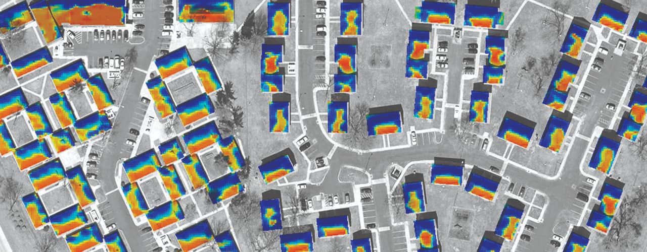
Woolpert partnered with ODSA and OGRIP to develop a solar potential map for Northwestern Ohio. The pilot project leverages Ohio’s comprehensive imagery and LiDAR datasets to help property owners throughout the state make informed decisions regarding solar panels.
From 2006 to 2009, Woolpert obtained LiDAR and imagery datasets for the Ohio Statewide Imagery Program (OSIP). Using this existing data, we measured over 250,000 structures in the 1,000-square-mile pilot area. The project team then calculated the amount of hourly solar insolation received at each structure over a one-year timeframe. The solar potential map can be viewed through a public portal, http://www.ohiosolarmap.org/. Based on Woolpert’s existing online imagery viewer, SmartView® Connect, the website enables users to search for properties; view solar potential points on a map and see the total and available rooftop areas and calculate estimates of potential annual output.
Woolpert's solution resulted in an interactive website that residents can use to estimate usable rooftop area, incoming solar radiation and the cost efficiency of installing solar panels.