TULSA INTERNATIONAL AIRPORT ELECTRONIC AIRPORT LAYOUT PLAN (EALP)/AGIS PROGRAM
Project Details
CLIENT
Tulsa International Airport
LOCATION
Tulsa, OK
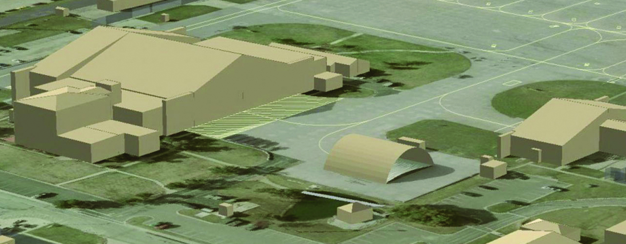
The goal of the Tulsa Airport Improvement Trust (TIAA) is to develop all new GIS database mapping and eALP data in compliance with the FAA Advisory Circulars and then build upon that data by developing a GIS database, deploying a web portal, establishing data standards and implementing data maintenance procedures.
To assist TIAA in its efforts, Woolpert created an FAA-approved eALP for the airport. The project included:
-
- Collection and delivery of aerial photography
- Topographic base mapping
- 3D facility modeling
- Validation of existing geospatial data
-
- Technical expertise
- Resource management
- Enterprise GIS experience
- Project steering support
The resulting process can be reused by the airport to make future eALP submissions, as well.