WISCONSIN DOT MOBILE MAPPING SERVICES
Project Details
CLIENT
Wisconsin Department of Transportation
LOCATION
Milwaukee, WI
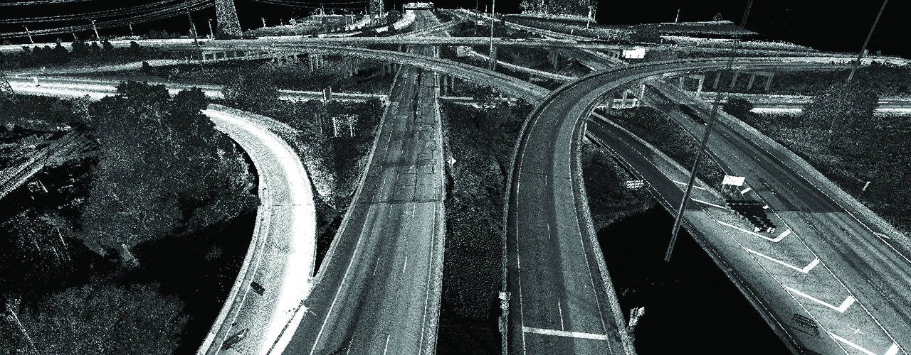
Because of construction at the interchange of I-94 and I-894 in Milwaukee—known as the zoo interchange because of the volume of traffic that travels it every day—the Wisconsin DOT is working with Woolpert to map the corridor. Woolpert is using our Lynx mobile mapping system to collect data for 10 miles of interstate mainline, 7 miles of system and service ramps and 10 miles of state highway. The data will be fused with existing airborne data as well as static LiDAR data collected by others and presented as a single, unified mapping project to support the construction.