BLOG
—
Partnerships Expand Woolpert’s Geospatial Footprint, Capabilities
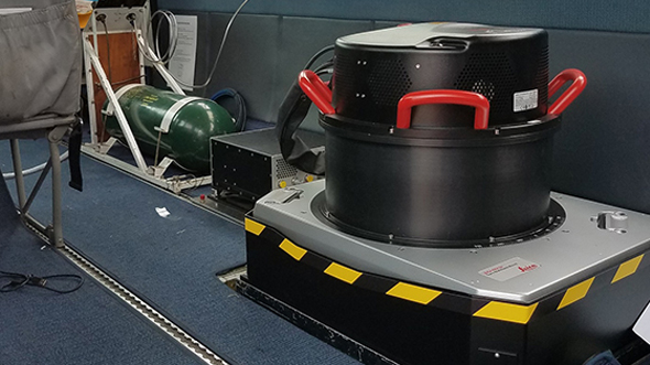
Over the last 50 years, Woolpert has built a reputation for being on the leading edge of providing geospatial services. These include collecting and processing lidar data and orthoimagery, flood mapping, coastal management, GIS, acoustic survey, urban 3D modeling, Google Maps Platform and Google Cloud Platform, etc.—as well as developing imagery hosting services like STREAM:RASTER and compliant raster and vector services like SmartView Connect, which provides access to imagery, elevation and remote sensing datasets while a project is underway.
But more importantly, we also have become well known for strategically supporting the specific needs of each federal, state, local, military or private client we serve.
To provide this support, we are continually developing and expanding our geospatial services both in-house and through strategic partnerships. We understand that success is not about us and what we provide; it is about optimally serving the needs of each client. Therefore, we have expanded our geospatial menu by joining forces with top geospatial firms across the globe to ensure we deliver innovative solutions for every project, every time.
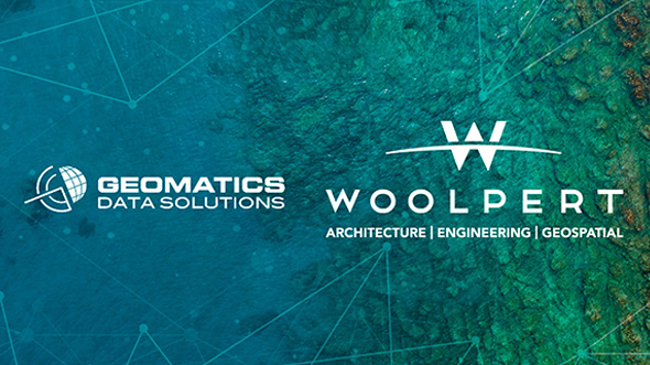
Southern Mapping and GDS
In 2019, Woolpert acquired Southern Mapping and Geomatics Data Solutions (GDS). GDS provides marine and terrestrial survey worldwide, and Southern Mapping is a geospatial solutions and aerial survey company based in Johannesburg, South Africa. Over the last seven years, Southern Mapping and its partner Airbus Intelligence have provided geospatial data and derived information datasets to the continent of Africa. Airbus, a global aerospace leader, utilizes satellite technology to collect imagery that can be updated and delivered on a weekly basis.
Airbus has proved useful in the oil, gas and minerals sector as well as in supporting infrastructure projects. Mining companies have used their services as safety measures to track land subsidence and change detection around active mines. In addition, Southern Mapping has integrated Airbus data into several consultancy and monitoring services and product offerings.
Southern Mapping also recently partnered with SatAgro, a new crop monitoring service that supports the agriculture industry. SatAgro provides satellite imagery and meteorological data for farmers to visually follow the development of their crops in near real time, from planting to harvesting, via the web or a mobile device.
Hexagon
Earlier this year, Woolpert made the strategic decision to join forces with Hexagon. This partnership enables our wide range of clients to have full access to the HxGN Content Program, and it provides a platform for Woolpert and Hexagon to collaborate on top solutions to advance the global mapping industry.
Hexagon collects imagery and high-resolution lidar from an airborne platform, capturing imagery of the U.S. in 15 cm and 30 cm resolution, with updates at approximately three-year intervals. Woolpert uses this imagery as an input to our remote-sensing algorithms and to augment our datasets, from which high-quality, color-balanced graphics and images verified through comprehensive ground control measures are derived. Our clients often use this imagery as a background for their geospatial environments and to augment remote sensing networks.
Like Woolpert, Hexagon uses the latest sensors and systems, so our geospatial experts are in sync on tools, products and data. This enables us to seamlessly extract additional value from these solutions beyond simple visualization. Hexagon’s catalog is especially useful when more current, updated imagery is needed for large geographic areas and when a custom collection would take too much time and not make sense financially for one firm to tackle alone.
Planet Labs
Just this month, Woolpert struck a new agreement with Planet Labs to increase our access to timely and highly frequent dataset refreshes. Planet Labs utilizes satellite technology and can provide daily updates of aerial imagery. Providing collections with a lower resolution and a higher cadence are Planet’s strengths. This approach is ideal for use cases that involve large-scale monitoring needs in which daily and weekly detecting and tracking are critically important.
Planet’s products are exceptionally useful in several monitoring endeavors. For instance, auto manufacturers can receive updated images on a weekly or monthly basis to count vehicles in the lots of dealerships across the nation and ascertain how many vehicles are selling. Planet’s products are also ideal for monitoring a river system and tracking infrastructure damages and changes to the environment during and following flood events. As soon as the sky is clear, we can provide updated information as the flooding is at its peak and as waters start to recede. In such instances, it would be cost-prohibitive to the client to perform custom collections alone at the rate the updated imagery and data is needed. Other use cases in which these frequently updated aerial images are crucial include monitoring deforestation, farm-crop health, changes in sporting events attendance and housing development growth.
We understand that our clients have many options in the global geospatial marketplace. Our job is to provide each client with a tailored solution for each project to reach or exceed its potential. We do this by employing all the tools and opportunities at our disposal, which—thanks to our outstanding in-house experts and strategic partnerships such as these—will just continue to grow.

Geospatial Cloud Series 2020
July: Partnerships Expand Woolpert's Geospatial Footprint, Capabilities
August: Evaluating Geospatial SaaS Platforms to Meet Business Needs
September: Remote Sensing Data at Home in the Cloud
October-November: With Great Power of the Public Cloud Comes Even Greater Responsibility
December: Series in Review: Where the Cloud Intersects with Geospatial