
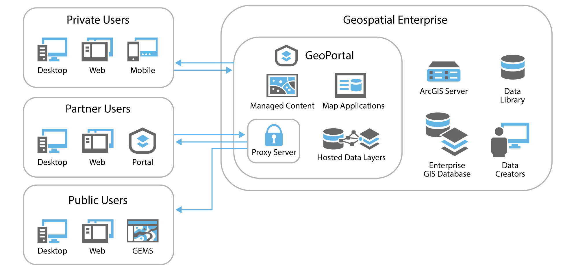
Enterprise GIS
While high-quality geospatial data can be virtually priceless, it also can be nearly worthless if it remains underused or untouched on a storage drive. Woolpert can help you find more value in your geospatial data by developing customized data analysis and dissemination tools and providing award-winning on-site geospatial support.
Our team of GIS specialists develops enterprise GIS solutions that power informed decision-making. We customize and scale existing applications to minimize expense, and when appropriate, we create new, client-specific tools driven by and designed around geospatial data. Using advanced technologies we can build solutions during any part of the GIS life cycle, from imagery and lidar collection to QA/QC, post-processing, feature extraction, data visualization, spatial analysis and complex GIS data modeling.
Maximize the value of your data with Woolpert
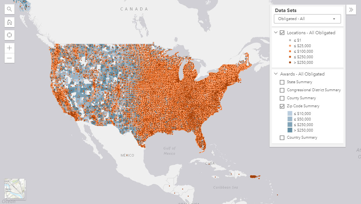
Data processing of over 37 million records for the Pandemic Oversight website.
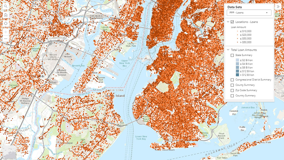
Custom map application development and geocoding of millions of rooftops for the Pandemic Oversight website.
Enterprise GIS Workflow
Services
- Installation support
- Cloud solutions
- Content management support
- Enterprise installation imagery and lidar data collection
- Geocoding
- Map application development
- Operations support
- PMO systems support
- Program support
- Strategy support
- Supply chain risk management support