BLOG
—
Creatively Collecting Upper Colorado Truth
As we all soldier on through the pandemic, carefully adhering to health guidelines from our respective health officers (I am a proud member of the Dr. Bonnie Henry Fan Club), many of the projects field personnel encounter pose interesting challenges not discussed on the government websites. I was recently tasked with collecting some ground truth for a bathymetric lidar project we were flying in Colorado that required some creative adaptation to complete safely, accurately and efficiently.
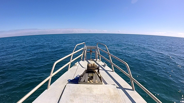
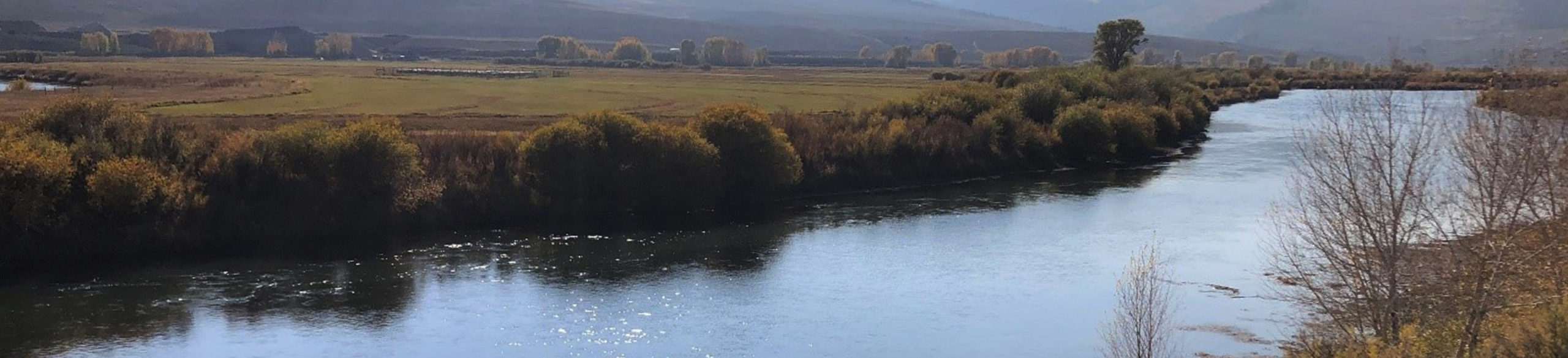
The project area covered reaches of two rivers, the Upper Colorado (as seen above) and Gunnison, in a picturesque, natural playground for outdoor enthusiasts. We were collecting the lidar with a Chiroptera 4X topo-bathymetric lidar sensor in our Cessna 404 Titan twin-engine aircraft. The Chiroptera is the latest sensor commercially available that collects simultaneous topography, bathymetry and four-band imagery at very high resolutions to support numerous requirements in a single pass. To validate the accuracy of the data, we collect ground truth points not only, well, on the ground, but also in the water. The bathymetric points also need to be over the entire range of water depths, so just wading the shallow sections is not enough.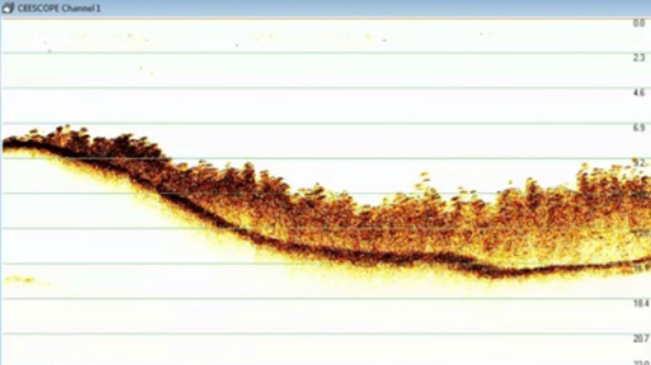
In addition to following rigorous company COVID safety protocols and local health orders, Woolpert has implemented a policy that minimizes our field footprint to reduce the exposure of our team. For the ground truth acquisition, this meant only one person would be sent out to the project site to collect all the data. Typically, a single-person crew can easily collect the topographic ground truth data as modern GNSS systems are very small and light compared to the days when I started surveying. Thankfully, the term “backpack” no longer exists in the rover vernacular... However, survey grade sonar systems and boats tend to be a bit more than one person can handle.
Figure 1: Sonar Echogram in Highly Vegetated Area
There are plenty of commercially available remote boat platforms, some even small enough for one person to carry. But none met the stringent requirements imposed for this particular use. The bathymetric platform must not only be portable by one person, but it also must be light enough to allow that person to also carry the equipment for topographic data collection to avoid multiple trips, since some of the sites where we wanted data were away from the roads. The bathymetric system also was required to use the same positioning system as the topographic system to simplify position checks for accuracy verification. This meant the soundings were positioned using corrections from not just the same base station, but the same receiver, a Trimble R10. And finally, the sonar system itself was to be a survey grade echosounder with precise timing and full echogram recording capabilities.
The full echo envelope is critical during data editing to understand the nature of the survey area, allowing the hydrographer to edit out vegetation or aeration in the water column and accurately digitize points. A CEE HydroSystems ECHO was used for this project, with data logged internally to the sonar and real-time guidance provided by a radio link to Teledyne RESON PDS2000 software.
Unsatisfied with the commercially available systems, I built a custom platform specifically for this project. It uses a lightweight inflatable hull with two electric thrusters controlled by open-source ArduPilot software. Although capable of autonomous operation, the cross sections required on this project were short enough to manually pilot the vessel. The R10 was mounted directly above the transducer, simplifying the offsets. The system was fully calibrated (latency test, bar check, position check) prior to the work, with additional quality control measures completed at each site to provide further confidence in the data.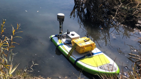
At each site, I collected upland topography overlapped with sonar bathymetry in cross sections. Additional NVA (non-vegetated vertical accuracy), VVA (vegetated vertical accuracy) points and lidar control points were also collected throughout the project areas. All topographic data collected met National Geospatial Program Lidar Base Specification v2.1, while the bathymetry met U.S. Army Corps of Engineers EM-1110-2-1003 Specifications for Inland Surveys.
Figure 2: Remote Bathymetric Platform (left)
The system performed extremely well, while garnering considerable attention from the folks fishing on the river. I was able to easily hike into sites with all the equipment needed to complete my tasks using a small backpack for the sonar and a control laptop strapped to the hull, while I carried the survey rod. So, it seems after all this time, the term “backpack” in this setting will continue to live on...
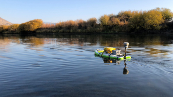
Figure 3: Remote Bathymetric Platform on the Upper Colorado River (left)
Ben Hocker
Woolpert Vice President and Hydrographic Project Manager Ben Hocker, CH, PLS, has more than 20 years of broad spectrum, global experience in marine survey and hydrography. His expertise includes multibeam and single-beam surveys, side scan sonar, mobile lidar and conventional survey techniques. Hocker works out of Woolpert’s Calgary office.
Share this Post