BLOG
Want 7x Better Orthoimagery? It’s a Renaissance®…
Complex and diverse, the modern world’s need for accurate and detailed geospatial information is continually growing. Governments, aviation companies, energy providers and a host of related organizations are pushing for leading-edge technology that can bridge the gap between detection and identification.
Meet Woolpert’s Renaissance® airborne system, which provides digital orthomosaics and DSMs with spatial resolutions nearly 7 times better than standard orthophotography. This innovation provides access to more identifiable information, and in turn, leads to lower project costs.
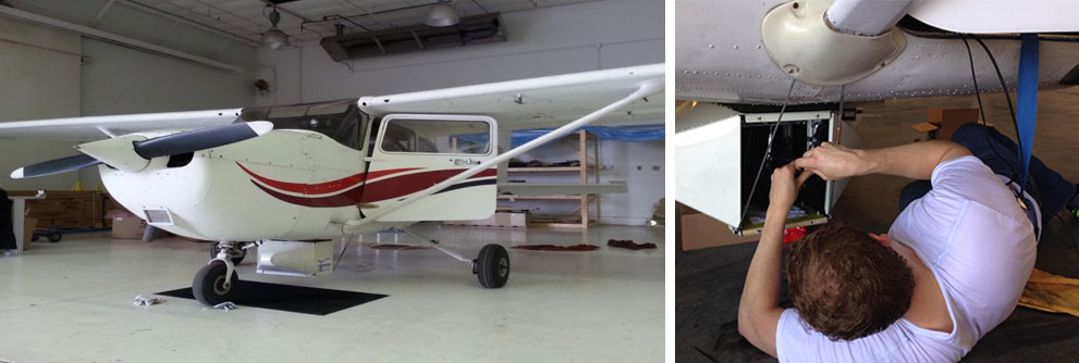
UAS mounted on Cessna aircraft
Currently, UAS data capture is limited by commercial FAA regulations, such as line-of-sight and non-participant fly-over restrictions. Woolpert’s Renaissance platform circumvents these limitations with high-quality UAS cameras mounted to manned aircraft. This unique hybrid approach merges the functionality associated with manned aircraft with the utility derived from UAS production workflows. Renaissance can also be flown over much larger project areas and those areas previously inaccessible to traditional UAS, making it especially beneficial to longer corridor projects.
At 2-cm spatial resolution, Renaissance imagery provides clearer images than past technologies. With ground control, Renaissance imagery can provide absolute accuracies of 3 to 4 pixels RMSE horizontal and 4 to 8 pixels RMSE vertical.
The forward-thinking Renaissance system is fully integrated with Woolpert’s SmartView® Connect, which provides quick and easy access to aerial imagery. For engineering planning purposes, Woolpert can produce point clouds and 2D/3D maps derived from this imagery within just a few days of collection.
Multiple Woolpert clients have used Renaissance to quickly assess and map proposed corridors in a variety of environments. The need for excessive field work and time-intensive survey access was eliminated, and the data was captured in a fraction of the time of traditional aerial and survey methods.
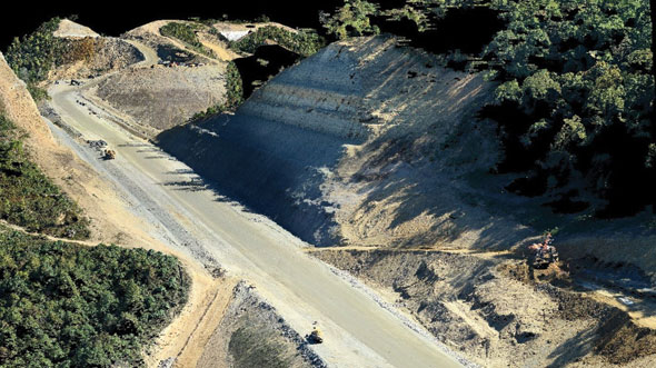
Imagery from Renaissance-acquired point cloud

Mike Zoltek, LS, CP, CFedS, GISP, is a land surveyor, photogrammetrist and GIS professional with over 20 years of experience. A member of the ASPRS Board of Directors, Mike certainly knows his way around a map—and how to make one.
mike.zoltek@woolpert.com
407.591.5010