BLOG
—
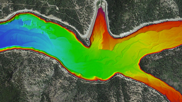
Accurately Mapping the Sea Floor
Mark Smits
Mark Smits, PMP, GCP-G, is a geospatial program director in Woolpert’s maritime market. A technical specialist, Smits is responsible for a wide range of geospatial services, ranging from photogrammetric mapping to multi-sensor digital data collection and processing.
Ben Hocker
Ben Hocker, PLS, is a Woolpert vice president and geospatial project manager. Hocker has more than two decades of marine survey and hydrography experience in multi- and single-beam surveys, side scan sonar, mobile lidar and conventional survey techniques.
Andrew Ericson
Andrew Ericson is a site lead and remote sensing specialist for Woolpert who helps the firm acquire airborne lidar data using a CZMIL sensor and ensures all data is appropriate to each project specification. In addition to his diverse technical background, Ericson also is a UAS pilot.