
Little Bighorn National Cemetery Digital Mapping
Little Bighorn National Cemetery Digital Mapping Combining modern techniques with century-old data, Woolpert helped the … Read More

MOT-70 Arlington Road Bridge
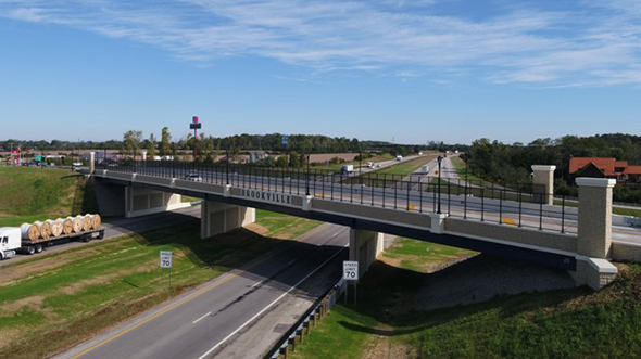
MOT-70 Arlington Road Bridge Background The Ohio Department of Transportation (ODOT) District 7 had a … Read More
Hurricane Sandy Lidar Acquisition

Hurricane Sandy Lidar Acquisition Woolpert acquired lidar data for over 250 square miles of coastline … Read More
Ohio Solar Potential Map
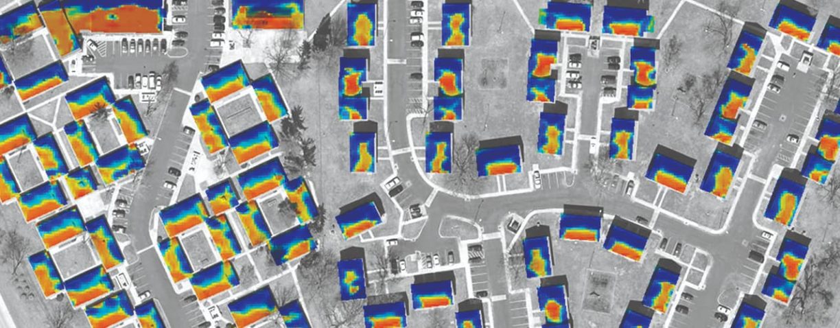
Ohio Solar Potential Map Woolpert partnered with ODSA and OGRIP to develop a solar potential … Read More
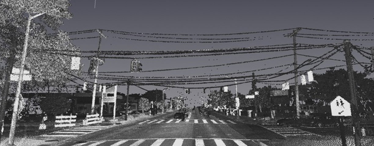
I-64/I-264 Corridor Lidar Scanning

I-64/I-264 Corridor Lidar Scanning Deteriorating pavement conditions prompted the Virginia Department of Transportation (VDOT) to … Read More
Mobile Lidar Pavement Scanning at Houston Airports
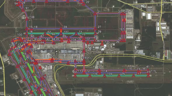
Mobile Lidar Pavement Scanning at Houston Airports The Houston Airport System (HAS) faced aging infrastructure … Read More
City of Columbus Impervious Surface Mapping
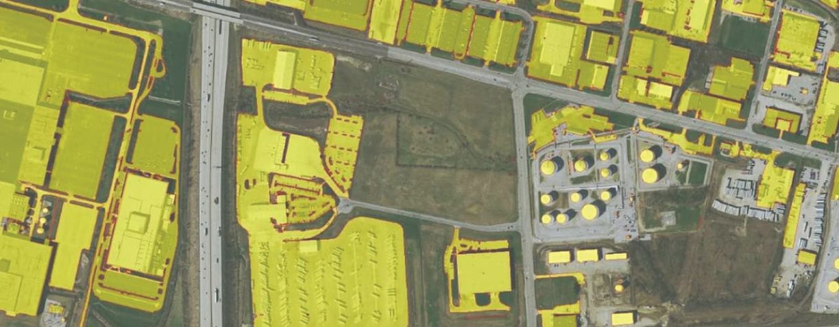
City of Columbus Impervious Surface Mapping In light of substantial population growth in the past … Read More
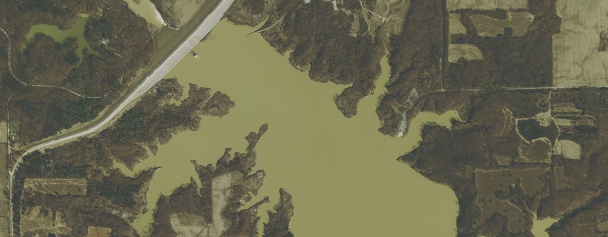
North Ohio Lidar Data Enhancement

North Ohio Lidar Data Enhancement When Lidar is collected over water features (lakes, rivers and … Read More