How Woolpert and Saildrone are mapping one of the Pacific’s most remote marine environments for NOAA
Key Takeaways:
- Woolpert collected high-resolution bathymetric data across nearly 16,000 square nautical miles of Pacific seafloor surrounding the Mariana Islands under NOAA’s longstanding IDIQ contract.
- To expand survey reach in remote marine environments, Woolpert partnered with Saildrone, which deployed its Surveyor-class uncrewed surface vehicle to collect data in areas where conventional survey operations can be difficult, costly, or resource intensive.
- The bathymetric data collected will help NOAA improve understanding of sensitive habitats, marine geohazards, oceanographic conditions, seafloor composition, ecosystem management, and understudied marine organizations.
Why Bathymetric Gaps Persist in Remote Waters
Remote waters, extended transit times, operating costs, and limited survey capacity continue to constrain hydrographic coverage in many of the world’s most difficult-to-access marine environments.
The waters surrounding the Mariana Islands are a prime example of this challenge. Extreme depths, distance from port, and hazardous sea conditions have historically made portions of the region difficult to survey using conventional methods. For organizations working to improve understanding of the area, access has often been as much of a challenge as data collection itself.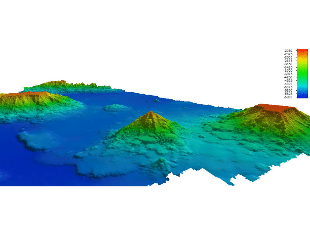
Working under NOAA’s longstanding IDIQ contract, Woolpert led the collection of high-resolution bathymetric data across nearly 16,000 square nautical miles of Pacific seafloor, an area roughly the size of Costa Rica.
To extend survey reach and efficiency in this remote region, Woolpert partnered with Saildrone as its acquisition subcontractor, leveraging autonomous survey technology to support data collection efforts.
Why Access Remains One of Hydrography’s Biggest Challenges
Traditional hydrographic surveys rely on crewed vessels that may spend days transiting to remote survey areas before data collection begins. Once on station, fuel requirements, crew logistics, weather windows, and operating costs all influence how much coverage can realistically be achieved.
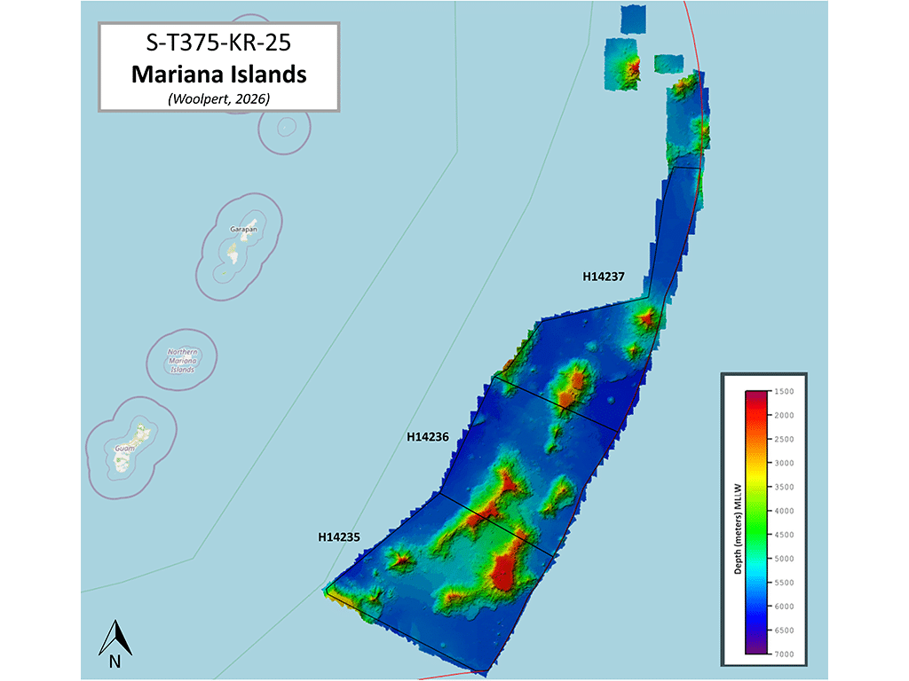
Those constraints become especially significant in remote regions such as the Mariana Islands.
Long-duration uncrewed surveying — combined with hydrographic expertise and automated geospatial workflows — can expand coverage in regions where conventional survey approaches face significant operational constraints.
For this effort, Saildrone deployed a Surveyor-class uncrewed surface vehicle designed for deep-ocean mapping. Its ability to remain on station for extended periods helps overcome some of the access and logistical constraints that have historically limited hydrographic coverage in remote regions.
Turning Collected Data into Decision-Ready Intelligence
Access alone doesn’t solve the problem. The value comes from turning collected data into information that agencies, engineers, scientists, and planners can use with confidence.
As the Surveyor worked across the project area, bathymetric data was transmitted back to Woolpert in near real time.
“By integrating Saildrone’s mission portal with Woolpert’s automated survey production environment, we gain real-time visibility into acquisition progress and data quality, especially in deep-water regions that were once difficult and costly to access,” said Dave Neff, Woolpert Maritime Market Director. “This collaboration shows how uncrewed systems and smart partnerships can expand what’s possible in ocean mapping.”
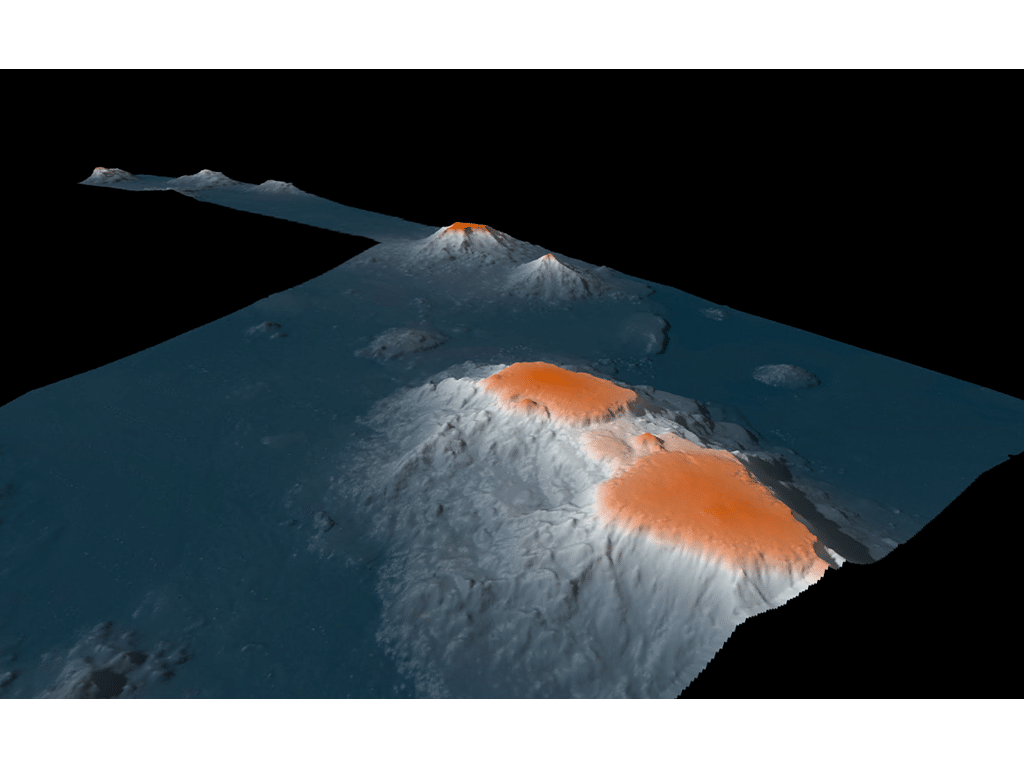
The partnership combines two complementary strengths. Saildrone extends the reach of data acquisition. Woolpert’s hydrographic and geospatial teams transform that information into bathymetric products that support planning, analysis, and smart decision-making.
The result is a more efficient path from collection to usable information, providing visibility into conditions in remote marine environments while the work is still underway.
The data collected through the Mariana Islands effort will help NOAA improve understanding of sensitive habitats, marine geohazards, oceanographic conditions, seafloor composition, and ecosystem management within the region. It will also support efforts to expand taxonomic reference libraries for marine organisms that remain understudied because their environments have been difficult to observe directly.
What this Project Suggests About the Future of Ocean Mapping
The Mariana Islands project offers a practical example of how access constraints can be addressed. Long-duration uncrewed operations make it possible to collect high-quality bathymetric data across remote areas that have historically been difficult, expensive, or time-consuming to survey.
For organizations working to improve understanding of remote marine environments, the question is no longer whether these areas can be surveyed, but how efficiently and at what scale.
If your organization is working to address seafloor data gaps, it’s worth a conversation about what’s now possible.