BLOG
—
How Port Tampa Bay Reopened Three Days After Hurricane Milton: The Power of Seafloor Mapping and Surveying
When most think about the damage hurricanes cause, they typically picture what happens inland: flooded streets, downed power lines, and submerged vehicles. However, another serious consequence of these storms is the damage they inflict on beaches, harbors, and ports.
Strong winds and surging waters will drag debris into bays or ports, making navigation hazardous. While the closure of any harbor can be devastating to a local economy, the impact is even greater for major commercial hubs, as was the case with Port Tampa Bay in 2024.
Hurricane Milton and the Closure of Port Tampa Bay
Hurricane Milton was a particularly destructive and deadly tropical cyclone that formed on Oct. 5, 2024, and dissipated on Oct. 12, 2024. On several occasions, it reached Category 5 status, the highest classification for hurricanes. Hurricane Milton wreaked considerable damage across the state of Florida, including Port Tampa Bay.
As Florida’s largest port, Port Tampa Bay ranks 12th in the U.S. by trade volume. According to a comprehensive economic impact study in 2024, the port supports more than 192,000 direct, indirect, induced, and related jobs annually throughout the west central Florida region. It also supplies 7 billion gallons of fuel each year to residents, businesses, military bases, and airports across the state—accounting for nearly half of Florida’s daily fuel needs.
Not all hurricanes pull debris into navigation channels. However, it is a requirement to conduct clearance surveys after certain category storms, like Hurricane Milton. Such risk management and hazard mitigation efforts are especially prudent when considering the possibility of an oil tanker striking an object.
While the closure followed standard protocol, it meant that commerce would come to a standstill, threatening millions of dollars in losses to the local economy if not resolved in short order. Observers noted a line of fuel tankers, cruise ships, and vessels carrying perishables waiting to enter. Moreover, emergency supplies would be unable to reach the state and its residents by way of Port Tampa Bay.
How Bathymetric Data Helped Reopen Critical Navigation Channels
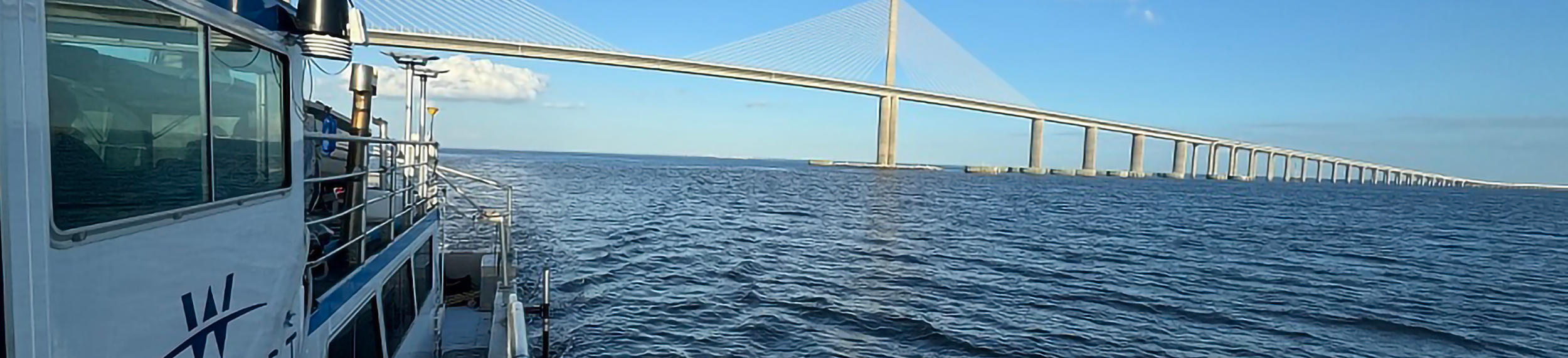
Officials needed to quickly reopen the port, but they had to first ensure navigation channels were clear of hazardous debris, which would require surveying and mapping the seafloor. Several notable entities were mobilized on Friday, Oct. 12, including the National Oceanic and Atmospheric Administration’s (NOAA) Office of Coast Survey, the U.S. Coast Guard (USCG), the U.S. Army Corps of Engineers (USACE), and Woolpert.
The plan was to coordinate the collection, processing, and delivery of bathymetric data, which would reveal the condition of Port Tampa Bay’s channels and the extent of Hurricane Milton’s damage. Recognizing the importance of speed, the Woolpert survey team worked from Friday evening to Saturday morning. In total, they surveyed and mapped the Tampa Bay entrance channel up to the Sunshine Skyway Bridge. They even pulled an all-nighter processing the data so that it would be ready in the morning.
The Woolpert team’s coordinated efforts with NOAA, USCG, and USACE delivered critical data into the hands of decision-makers in under 18 hours. Thankfully, Woolpert’s findings indicated that there were no shoals or piles of debris in the bay created by the hurricane’s powerful winds. This information enabled the port to reopen the inbound corridor of the Tampa Bay entrance channel at noon EST Saturday, Oct. 13. With vessel operations restored, maritime commerce and emergency aid could pass through the port to Tampa Bay residents.
What Key Takeaways Can Ports and Coastal States Glean from This Project?
The swift reopening of Port Tampa Bay was nothing short of impressive, occurring mere days after Hurricane Milton made landfall. This feat would not have been possible without the effective collaboration and tireless efforts of all of those involved—especially the navigation response teams and Woolpert’s survey team.
For other major ports located in areas expected to experience increases in severe weather, such as the Atlantic Ocean and the Gulf of America, the rapid reopening of Port Tampa Bay serves as an archetypal case study. A NOAA spokesperson stated that having contractual relationships and mechanisms in place, like teams dedicated to mapping and surveying the port’s channels, enabled them to accelerate the resumption of maritime commerce.
Seafloor surveying and mapping play a key role in both emergency response situations and coastal resilience efforts. Major ports—and coastal states in general—must map their coastal assets to better evaluate hurricane impacts and accurately track the performance of restoration projects. The Florida Seafloor Mapping Initiative, for example, is a testament to the fact that hurricane and coastal resilience begin with the seafloor.
Prioritizing Disaster Preparedness and Coastal Resilience
With extreme weather events on the rise, it is imperative that state and local officials in coastal regions prepare accordingly. Establishing the right contractual agreements, operational protocols, and partners—like lidar mappers and surveyors—ahead of time will not only enable speedy recovery from natural disasters but also strengthen overall coastal resilience.

David Neff
David Neff is an ACSM-certified maritime market director at Woolpert. He has managed hydrographic projects across the United States and internationally, with extensive experience in project management, vessel mobilization, survey planning, data collection and processing, report writing, business development, and product generation.