Commercial Airborne Services
Woolpert collects and processes high-resolution imagery, lidar and shoreline topo-bathy data for clients around the world. With accuracy levels determined by project needs, Woolpert’s high-quality data integrates cleanly with existing legacy data. We collect data quickly and with transparent levels of quality control, all while ensuring costs and equipment are aligned with project requirements.
Woolpert offers a worldwide resource pool of certified pilots, sensor operators and surveyors who have extensive training in commercial airborne technology, policies and procedures. Our graphically dispersed team and wide range of available aircraft and sensor assets allow us flexibility to provide a cost-effective solution to support standard and rapid-response requirements in CONUS and OCONUS regions, while streamlining the approval processes through local resources in host nations.
Our commercial airborne options incorporate the expansive local knowledge of airspace laws and protocols, as well as the related experience in coordinating for airspace permission, which results in a faster authorization window. This quick turnaround time allows for the efficient delivery of data, optimizing the ability to accomplish projects overall. This is particularly crucial when rapid response is needed in emergency and natural disaster situations.
Aircraft can collect imagery and lidar data in concert to create 3D elevation data and provide detail, accuracy and consistent quality for community-level decision support. These datasets can be collected once and used many times by governmental units to address critical, urgent issues like forest management, water planning and monitoring invasive species—and can be used by programs that will benefit infrastructure, economic development and emergency response.
Value-Added Products
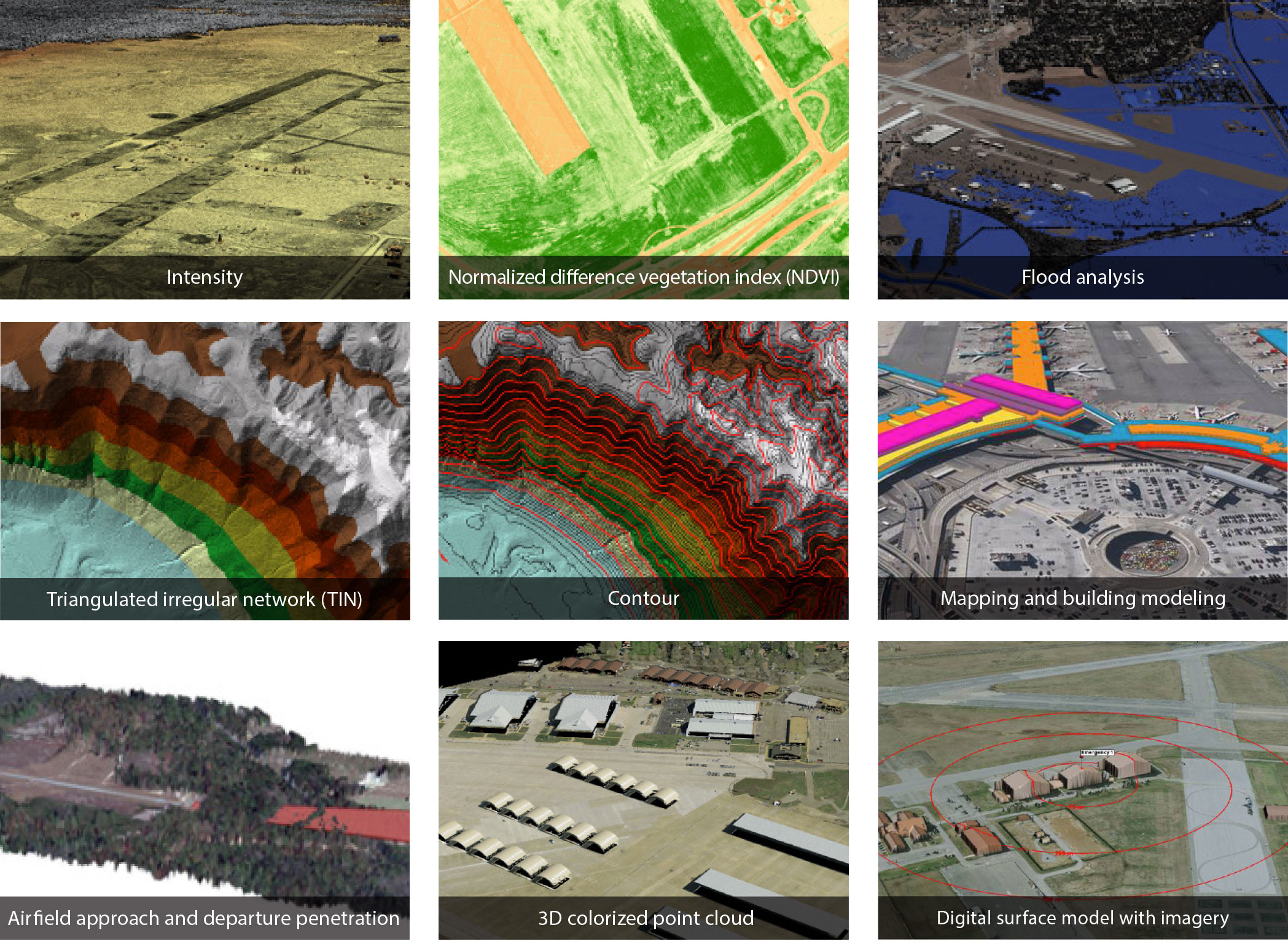
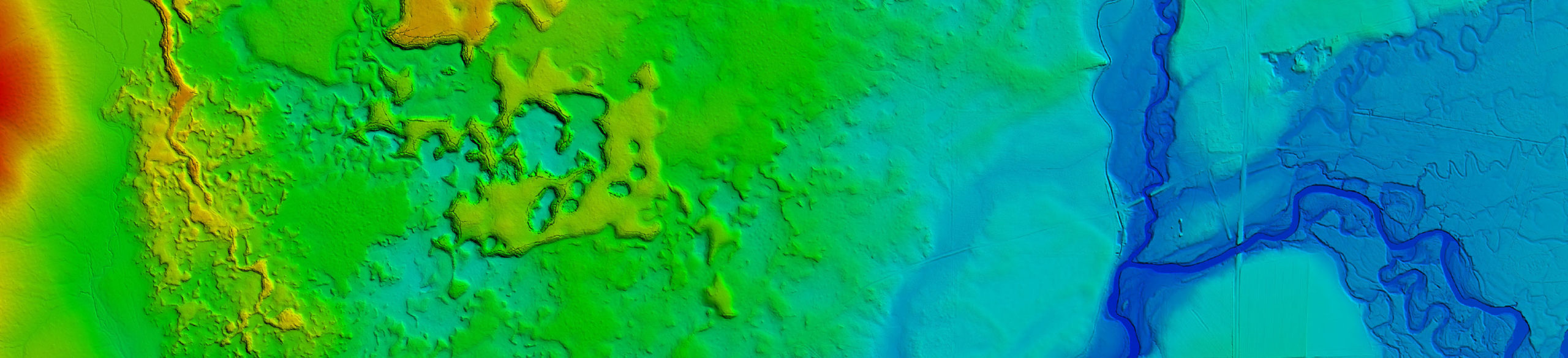
Benefits of Aerial Photography and Lidar Data
High Resolution
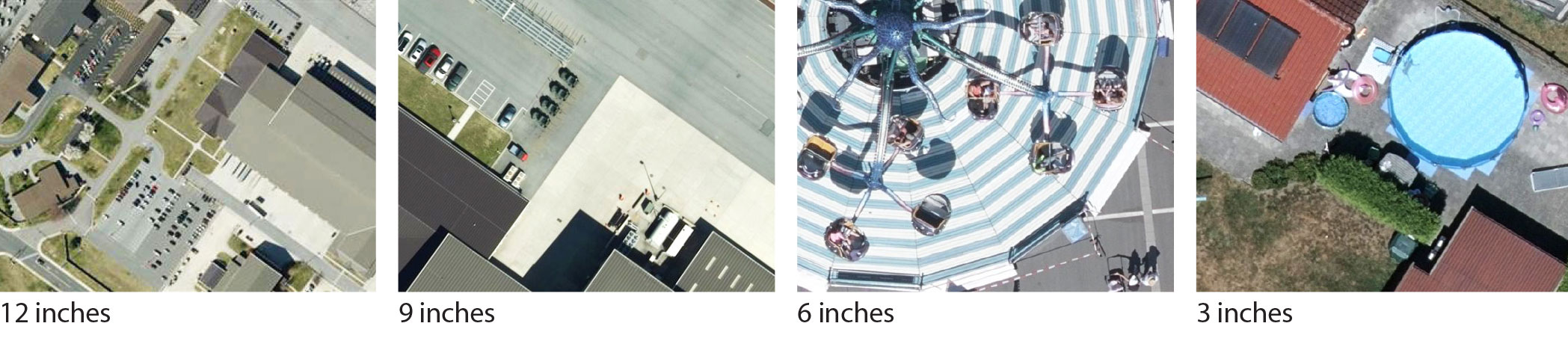
High-resolution aerial data supports object-based analysis and management, and the automation of these processes depends on it. While commercial satellite imagery ranges from 30 cm to 1.5 m resolution, aerial imagery can be achieved at 7.5 cm resolution or better with ease using advanced camera technologies. In addition, lidar is collected at 8 ppsm (or 0.35 m post spacing) or greater for enhanced feature detection, elevation modeling, and other various data analytics and applications. Supporting ground control surveys ensure optimal accuracy of orthophotography and lidar datasets while providing positional consistency with legacy datasets.
Positional Accuracy
Captured in stereo, aerial imagery with supplemental survey control provides positional accuracy of approximately two times the data resolution and better consistency with legacy datasets. Stereo imagery from commercial satellites is extremely limited and does not include survey control for enhanced positional accuracy; its positional accuracy is seven to 25 times the data resolution. The airborne lidar data is computed with a relative vertical accuracy of 10 cm RMSEz or better with swath overlap and absolute vertical accuracy of no greater than 15 cm RMSE.
Optimized Acquisition
Simultaneously collecting aerial imagery and lidar data saves time, money and resources. Because the sensors, aircraft and flight parameters are flexible, acquisition missions can achieve multiple goals in a single flight. In addition, data from aerial acquisitions is not compromised by atmospheric effects. Commercial satellite data, which is captured from fixed platforms on fixed orbits, can include significant cloud cover that renders it much less useful.
Resolutions for Every Need
Services
- Aerial thermal infrared imaging
- Airborne bathymetric lidar
- Cloud solutions
- Geodetic control surveys
- GIS
- Mobile mapping
- Sensor integration and testing
- Subsurface utility engineering
- Terrestrial scanning
- Unmanned aircraft systems
Practical Applications
- Community decision support
- Disaster preparedness and response
- Ecosystem restoration support
- Emergency management
- Energy planning and siting
- Firewise risk mapping
- Flood risk assessments
- Future construction planning
- Geologic fault identification and monitoring
- Infrastructure geodatabase management
- Infrastructure management
- Invasive species mitigation
- Landslide mitigation
- Ongoing operations management
- Shoreline management
- Sustainable forest management
- Water supply and quality monitoring
- Wildlife inventory and management