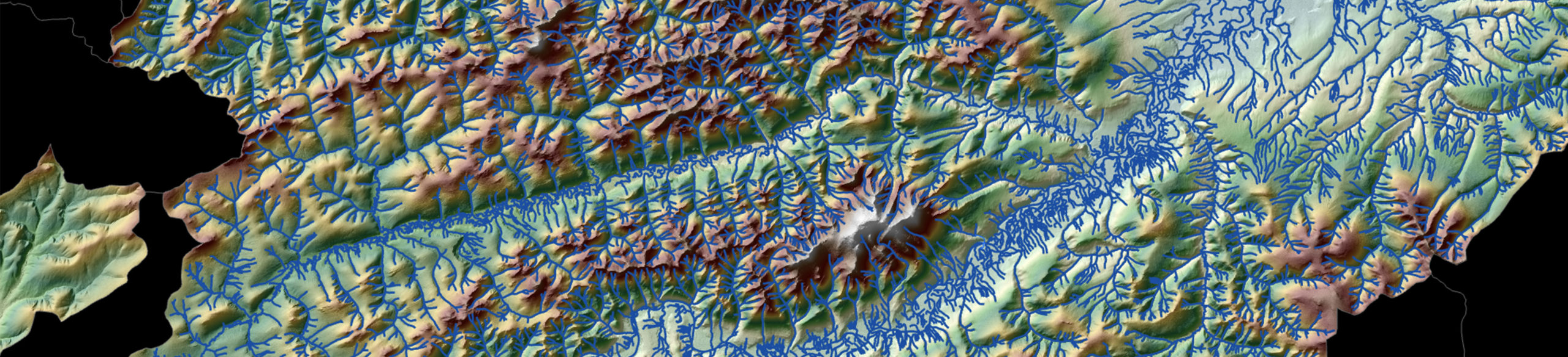
Elevation-Derived Hydrography
The dynamic nature of water shapes our ever-changing physical landscape and shortens the shelf life of accurate geographic data and analytic products. Elevation-derived hydrography (EDH) uses lidar data, human-built features and detailed landscape classifications to create true-to-life representations of water flow patterns. The U.S. Geological Survey and state and local government agencies have come to rely on EDH for the most accurate, up-to-date surface water data and maps.
Why Woolpert?
Woolpert isn’t just an EDH provider—we’re a national leader in EDH’s primary data source: high-resolution lidar. When you select Woolpert to develop your hydrographic data, you will receive:
- Cross-discipline solutions that integrate various datasets and systems
- Decades of expertise in lidar, hydrography and GIS/CAD applications
- Highly automated EDH processes incorporating local and regional datasets
- Hydrographic data that is far denser, more detailed and more accurate than existing data
- Surface water networks ranging from a city block to a multi-state region that are primed and ready for hydrologic and hydraulic modeling
Quality You Can Count On
-
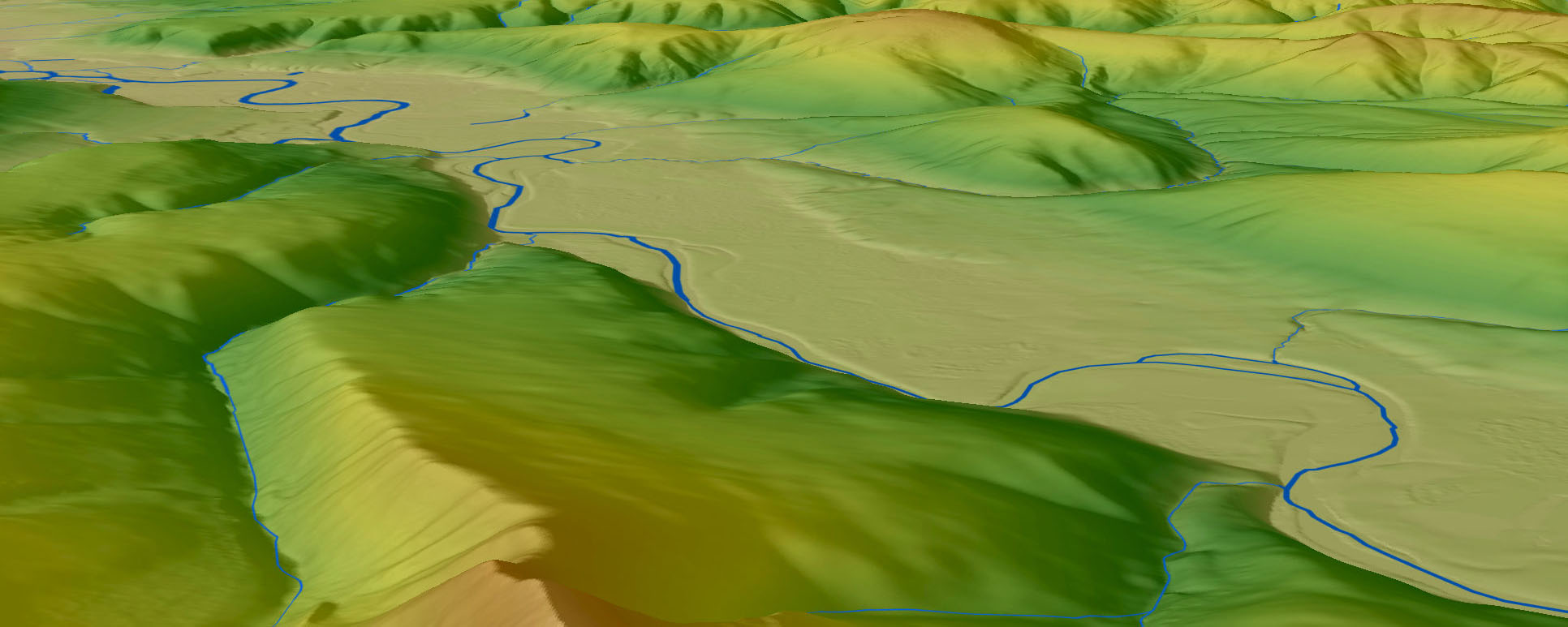
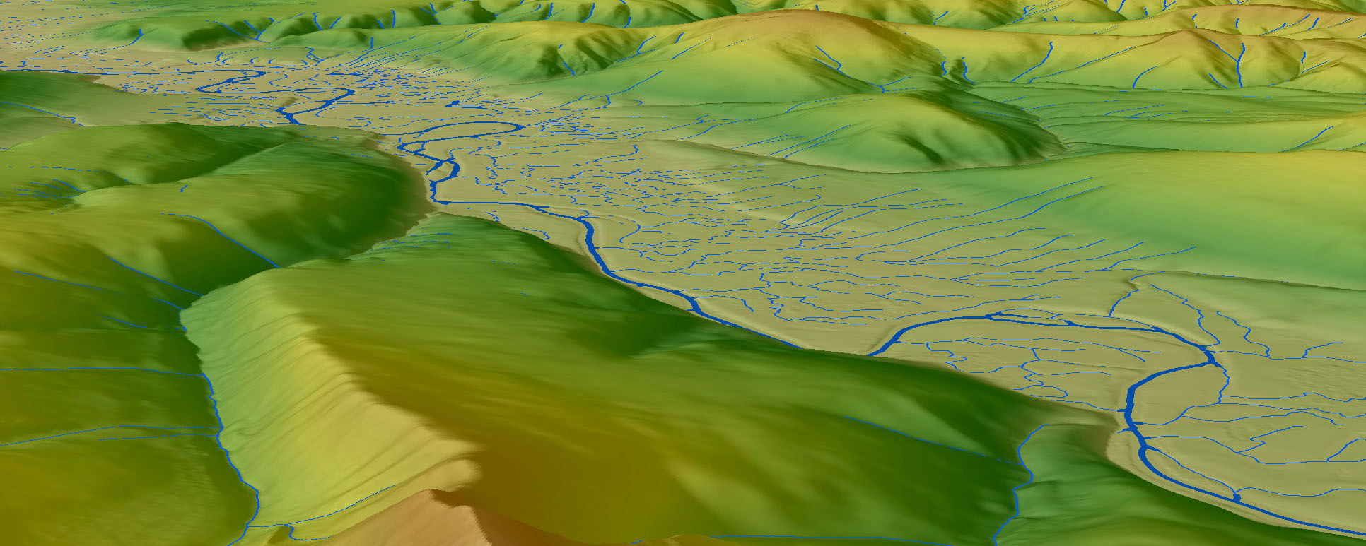
Traditional hydrography Woolpert's enhanced EDH
Our award-winning team is skilled in the end-to-end lidar production processes used to inform quality EDH outputs, and our resource specialists apply their knowledge of hydrology and geomorphology for more precise visualizations. We customize EDH development based on the components of the specific landscape, adapting on-the-fly to deliver more useful and dependable products.
Woolpert’s EDH data incorporates small and ephemeral streams to develop hydrography data up to four times denser than existing surface water data. We capture fully connected hydrologic networks, enabling any location within the network to be traced both upstream and downstream. Together, these qualities make Woolpert EDH data the superior choice for applications such as hydrologic modeling and flood risk management. Standard EDH deliverables include:
- Improved and densified hydrographic features (flowlines, bodies of water and other surface waters), conflated to the National Hydrography Dataset
- Refined watershed boundaries for all applicable USGS hydrologic units (with pour points for each), conflated to the Watershed Boundary Dataset