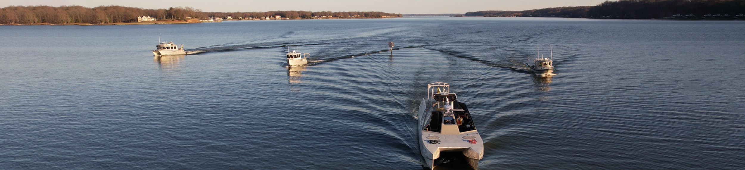
Maritime
- Coastal and riverine engineering
- Coastal and riverine resilience
- Critical infrastructure design and assessing
- Habitat modeling and assessing
- Nautical charting
- Regional sediment management
Services
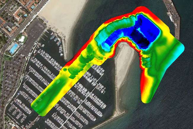
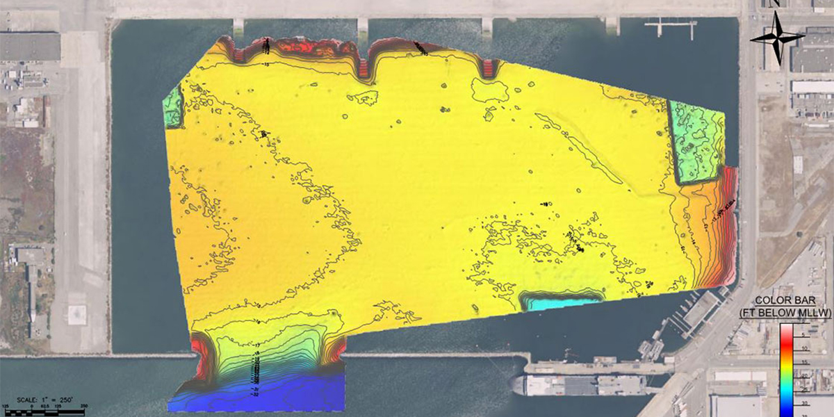
Bathymetric Mapping
Dredging Quality Management
Electronic/
Automated Positioning
Emergency Response
Environment Remediation
Geodetic Survey
Geophysical Survey
Marine GIS
Marine Vegetation Mapping
Object Detection
Oil and Gas
Terrestrial Lidar
Bathymetric Mapping
Bathymetric mapping is a specialized industry: our professional staff holds advanced degrees, professional land survey licenses, CG Captains Licenses, CDL and DOT certifications, extensive training and certifications by the ACSM/THSOA. Our staff brings decades of professional experience acquiring multibeam, single-beam, side-scan and sub-bottom sonar data in the most challenging coastal environments. The hydrographic surveys performed by Woolpert adhere to IHO, USACE and NOS Hydrographic Survey Standards and are supervised by certified hydrographers and professional land surveyors.
Woolpert has completed large and small scale hydrographic survey projects for government and private clients across the U.S. and internationally. Our most common survey areas include California, Alaska, Hawaii and the Great Lakes region. Our gear is completely mobile, and we can travel and mobilize any vessel worldwide. Our products, analysis, thoroughness, expertise and prompt delivery have created regular repeat clients and multiple sequential awarded contracts through NOAA and USACE.
Dredging Quality Management
In addition to providing hydrographic survey support for dredge projects, we offer custom USACE dredge quality management-/silent inspector-compliant systems for dump scows, hopper dredges and other marine construction equipment. Woolpert provides the technology, equipment, documentation, reports and data forwarding necessary for contractors to meet their USACE contract obligations.
USACE Profiles Supported
• Tracking
• Monitoring
• Ullage
• Tons dry solide
Environmental Protection Agency Vessel Monitoring
• Full sensor spread to meet third-party requirements
• Email alert system
• Secure FTP data upload
Electronic and Automated Positioning
Woolpert provides positioning services for a number of marine applications including commercial diving applications, bridge pier maintenance and pipeline stabilization. With the use of technologies such as MS-1000 side scanning sonar and Blueview 3D scanning sonar, we provide real-time positioning in challenging marine environments to support most any marine construction project. With USBL tracking beacons, we can track and position towed systems and sonar during survey operations. We also use USBL beacons to track diver positions while working on marine construction projects.
Our technology has been applied to a full range of machine control installations, from hydraulic cutter-suction dredges to hopper dredges with multiple sensors inputs and PC and PLC integration. We combine creativity and field-tested experience with fully-integrated circuit design, programming and construction capabilities to provide tailored solutions to our clients. We also provide wireless telemetry options to allow for remote viewing, training and bidirectional data access for increased safety and productivity.
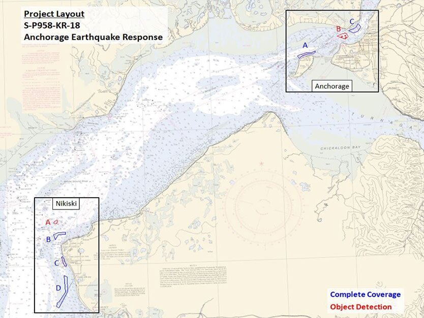
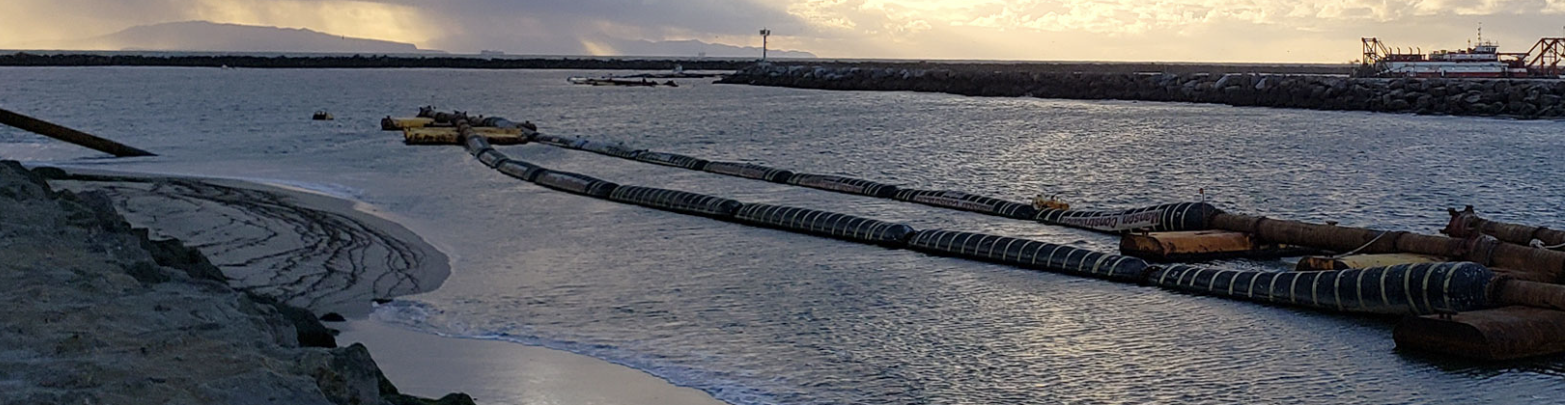
Emergency Response
Woolpert's prompt response rate and quick data delivery turnarounds for time-sensitive situations provide critical information in emergency decision-making. We provide forefront support to natural disasters such as earthquakes near ports and shipping channels as well as logistics catastrophes such as dam failures, sinking barges, potential oil leaks and anchor drags over marine utilities. Due to our large fleet and ample equipment inventory, Woolpert can arrive on site within hours of being notified. Woolpert surveyors canperform any last-minute request the client or circumstance requires. Our gear is mobile and ready to ship worldwide to be used on any vessel.
Environmental Remediation
Woolpert's knowledge and array of top-of-the-line equipment enables in-depth resource analysis and tracking. We have been tasked with sediment change analysis over days and years, identifying and tracking features in protected marine areas, determining sediment differentiation in ocean disposal sites, analyzing the integrity of waste outfall pipes, and locating objects for removal to proceed with other marine logistics. Using our suite of software, we provide difference surfaces, cross-sections, volume calculations, object detection and tracking, spans or inflections over a pipe and sediment classification. A range of deliverables can be provided per the client’s request.
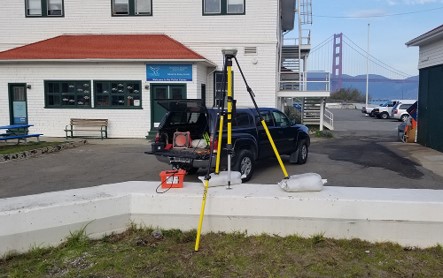
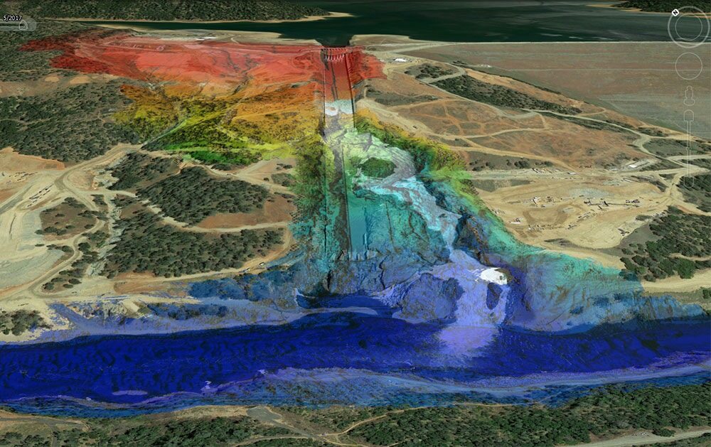
Geodetic Survey
Woolpert sets benchmarks and establishes horizontal and vertical controls while adhering to NOAA and USACE standards. Static GPS sessions and differential leveling runs are used to establish local control with most projects. Topographic survey services are available to support coastal mapping projects, including shoreline monitoring, dune restoration and buried beach utilities such as manholes and transformers. Topo surveys are used independently or combined with multibeam datasets for a virtually seamless overlap of the two. By combining multibeam sonars with topographic data, Woolpert creates merged point clouds throughout the coastal environment, regardless of waterline location.
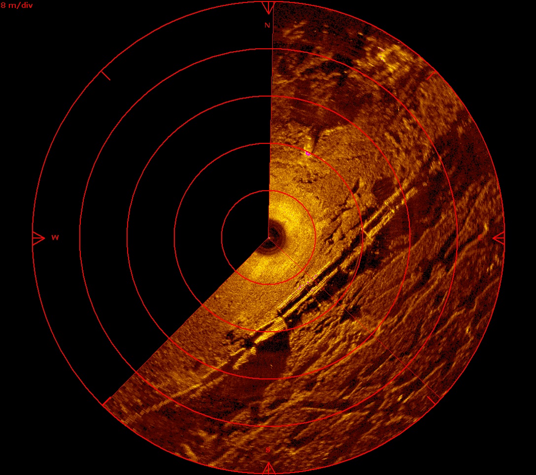
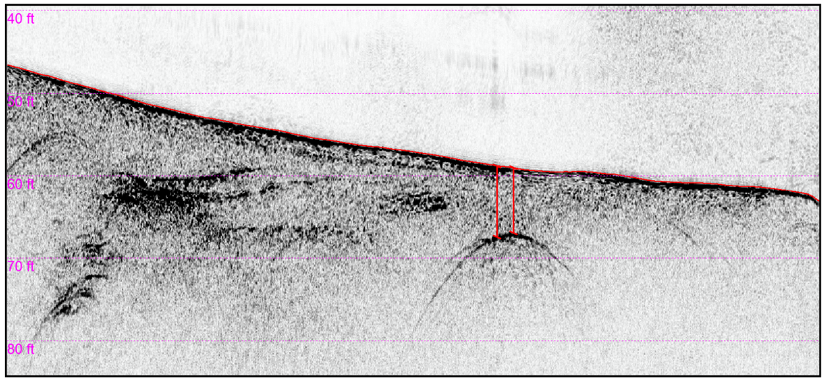
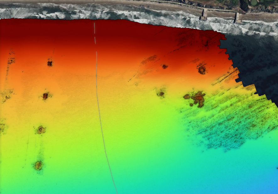
Geophysical Survey
Our knowledge and array of top-of-the-line equipment allows for in-depth identification, tracking and analysis of buried pipelines, cables or resources. Woolpert has been tasked with digitizing buried pipeline or cable alignments, locating anchors and even unexploded ordinances left behind from WWII. Within a single geophysical survey, buried pipelines or cable alignments, inflections, crossings, objects near the alignment and sediment classification can be defined. If surveys are repeated quarterly or annually, updated burial depths and analysis on significant sediment movements can be completed. Based on the client’s preference, deliverables include custom feature databases to identify tracked features in formats such as ArcGIS databases, custom CSVs, CAD plots and in-depth reports.
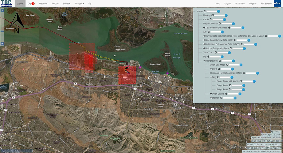
Marine GIS
Custom marine GIS websites provide an accessible platform for our provided services specific to each client. All included surveys and features can be toggled on and off in a layer menu option. During survey operations, these websites are updated daily with bathymetric and side-scan coverage so clients can track our progress throughout the survey area. Upon completion of data collection, client-specified features such as marine utility alignment, spans, inflections, objects, wrecks, geological features, difference surfaces and more are incorporated into the site. Feature locations are marked with points or polygons based on feature shape. Each feature can be clicked on and a pop-up window will appear with additional details and point cloud imagery. ROV locations with working video links as well as current and archived vessel traffic near the survey area can also be included. If the survey is reoccurring, difference surfaces and areas with significant sediment movement can be provided in the layer menu option.
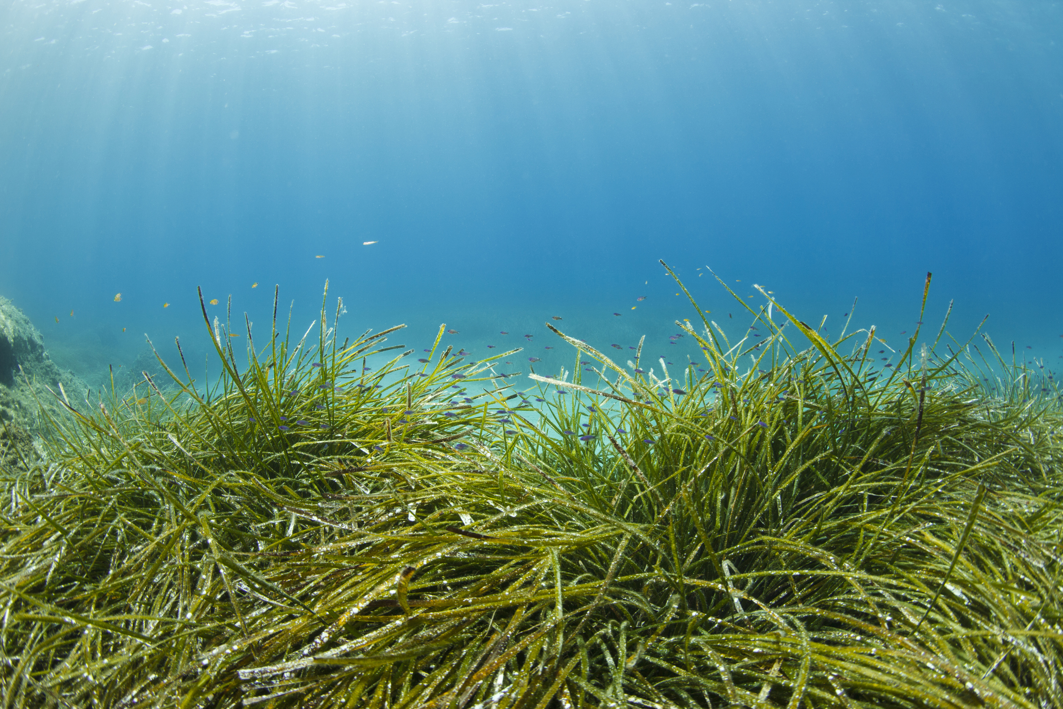
Marine Vegetation Mapping
Woolpert's equipment and software enable various collection modes, such a ultra-high-density and high-resolution, to emit over marine vegetation for high-detail location tracking. We have surveyed marine seagrass, eelgrass and corals with the focus to protect and prevent further loss of these marine environments. Woolpert has worked with highly protected eelgrass, including the movement and re-nourishment of eel-grass correlated to dredging operations.
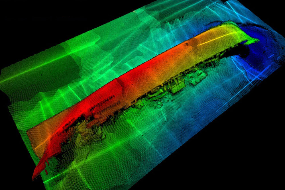
Object Detection
Woolpert uses cutting-edge technology to detect objects with accuracy. We have been tasked with a variety of object detection surveys including annually analyzing a shipwreck near a natural gas platform, detecting objects and routes near marine utilities, comparing shipwrecks to nautical charts to produce Danger to Navigation reports, detecting lost anchors in recovery efforts and locating the positions of submerged barges in emergency situations. Whether clients are looking for something specific or just looking to see what could hinder an area's shipping and dredge operations, Woolpert helps identify, image and track objects in formats such as ArcGIS databases, custom CSVs, CAD plots and in-depth reports.
Oil and Gas
Woolpert regularly provides services to oil and gas pipelines with ultra-high-density and high-resolution multibeam sonar data, side-scan, magnetometer and sub-bottom systems. We generate accurate pipeline alignments of exposed sections and depths and alignments for buried sections. With a single multibeam survey, pipeline alignments, spans, inflections, crossings, objects near the alignment, sediment classifications, and sandbag and/or mat locations can be defined and compiled in a geodatabase. Buried alignments and depths can be defined if a sub-bottom system is used during survey operations. If a survey is repeated quarterly or annually, we can complete in-depth analysis including recently completed stabilization efforts on spans, pipeline alignment movement, updated burial depths, object locations and significant sediment movement. Based on client preferences, deliverables include custom feature databases to identify tracked features in formats such as ArcGIS databases, custom CSVs, CAD plots and in-depth reports.
Woolpert has completed pipeline decommissioning surveys as well as route planning surveys using multibeam, sub-bottom and magnetometer sensors. We also provide emergency services for any possible leak or natural gas plume investigation by collecting and analyzing water column data concurrently with multibeam data.
Terrestrial Lidar
Woolpert completes high-resolution static and mobile terrestrial lidar surveys for a range of industry needs. These datasets are used independently or combined with multibeam and topographic datasets for a virtually seamless overlap while also acting as a data quality control tool. By combining multibeam data collected during high tide with 3D terrestrial laser scans collected during low tide, Woolpert generates merged point clouds throughout the coastal environment, regardless of waterline location. This capability has proven itself to be highly effective in a number of applications. Woolpert has been contracted to collect lidar data along breakwaters, dam faces, tunnels and piers for structural analysis. Terrestrial lidar is a great alternative to topographic surveys when possible and is also used to get absolute coordinates on features and objects not easily accessible.