Derivative Data Products
Woolpert leverages the wealth of information in high-resolution imagery and lidar datasets to extract derivative products and disseminate intelligent geospatial data. We begin by collecting data via a wide variety of aerial, terrestrial and aquatic acquisition methods, including crewed, uncrewed and satellite platforms. Then, we apply a combination of proprietary processes, machine learning and manual verification to extract planimetric features such as buildings, vegetation and other landscape features, as well as how these features change over time.
Learn more about some of Woolpert's turnkey derivative data products:
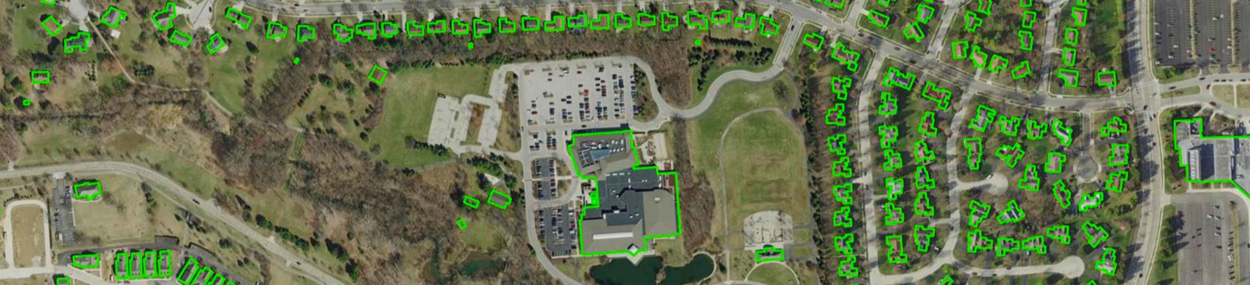
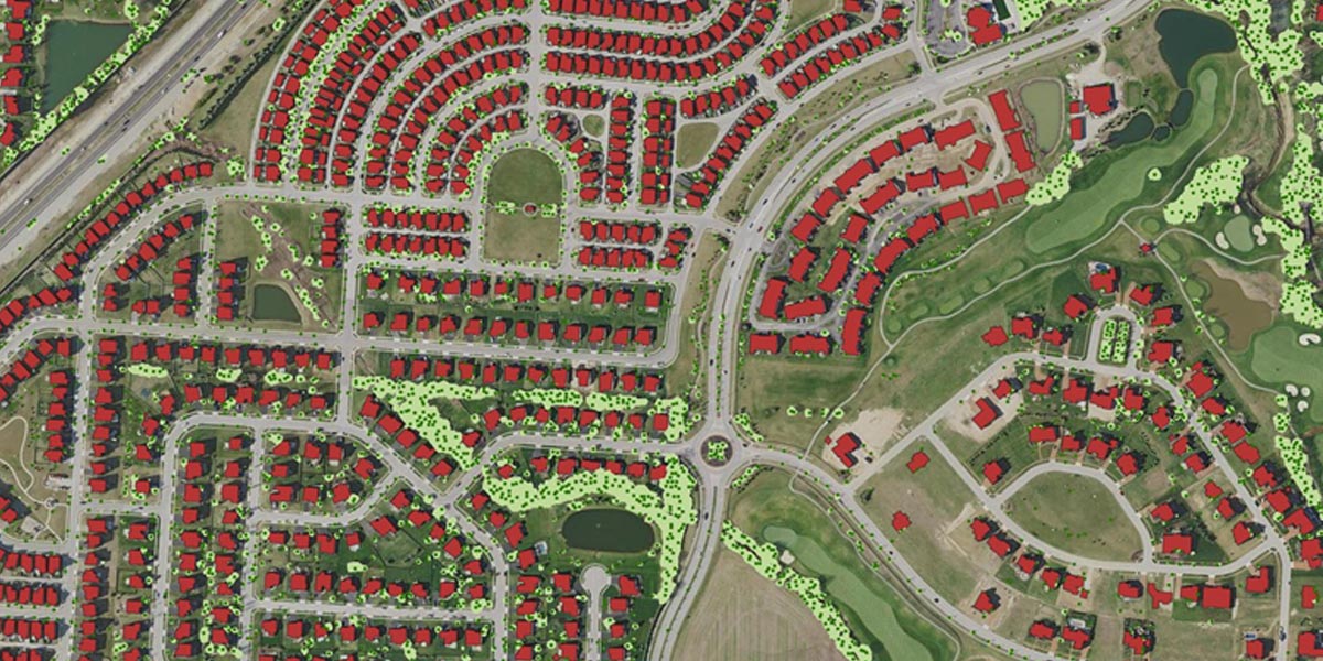 By combining customized, in-house applications with the latest orthoimagery and lidar datasets, Woolpert can delineate and attribute individual building footprints. Our semi-automated approach provides a cost-effective alternative to more expensive—and time-consuming—manual techniques. Building delineation and attribution for structures approximately 100 square feet and larger are derived from applicable high-resolution orthoimagery along with classified lidar datasets. We begin by identifying sample sets of representative land cover, terrain and built areas across the project area. Then, we develop and apply tailored classification algorithms followed by rigorous statistical and visual analysis techniques to review and validate feature classification accuracy.
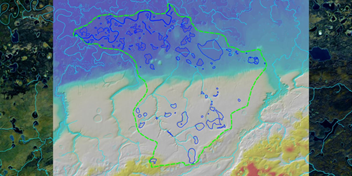 Woolpert is experienced in producing elevation-derived hydrography that qualifies for National Hydrography Dataset conflation. Our proprietary workflows combine automated and interactive mapping to produce complete drainage networks from lidar data and derivative breaklines. The result is a high-resolution, accurate 3D hydrographic dataset with direction of flow.
 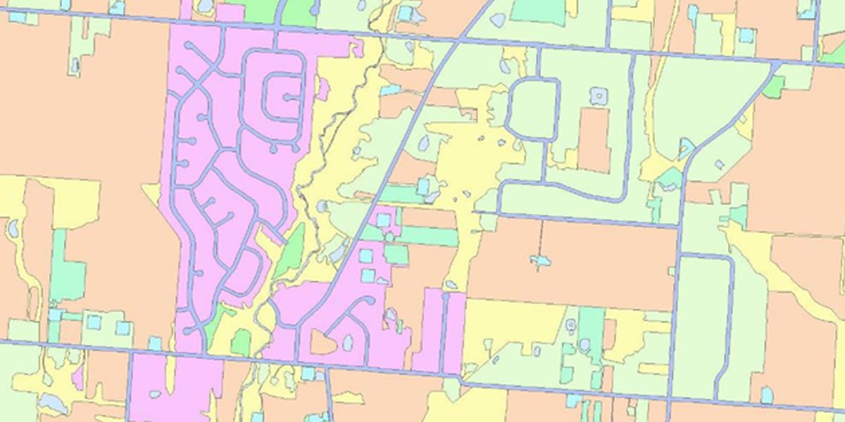 Our tailored and automated workflows consistently provide clients with a reliable and economical way to develop and maintain land cover and land use data over a diverse library of landscapes. Woolpert’s process is designed to enable fully repeatable results, that will produce detailed accurate change detection over time.
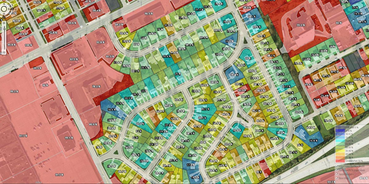 Use Case: Impervious Surface Mapping
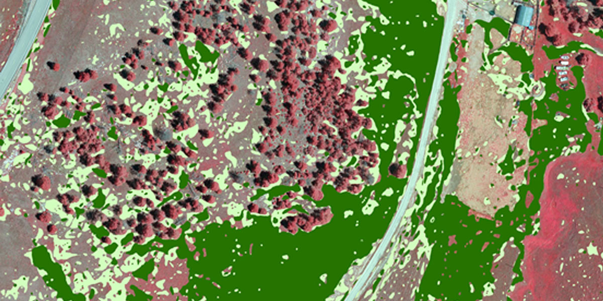 Use Case: Controlling Invasive Species
Contact

Recent Articles
With Great Challenge Comes Great Opportunity: Mapping Yellowstone, Upper Colorado River
Catching Fire: Ohio is Blazing Trails with Exponential Lidar Applications
Penetrating the Hawaiian Canopy
QL0 Lidar Data Provides Highly Accurate Roadmap for Blueprint Columbus