BLOG
—
Witnessing the Dawn of 3D GIS and Smart Cities: Part I
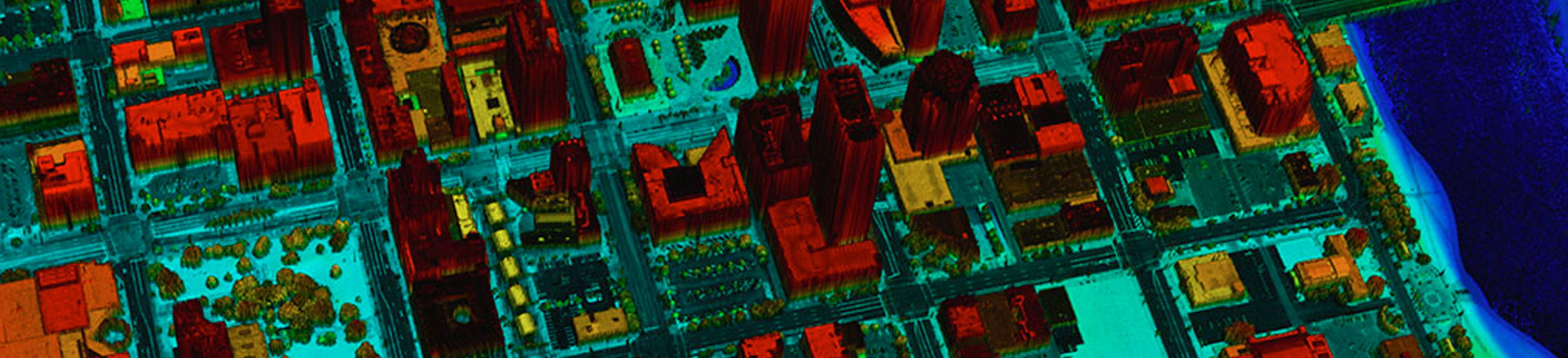
Smart cities are attracting attention worldwide among the GIS community and users of GIS databases. But what are they? The concept of a smart city refers to the deployment of new knowledge-based technology for improved quality of life in cities and enhanced city-wide asset management. To name a few examples of what we mean, smart cities can potentially deploy transit in response to real-time congestion, produce energy in response to actual demand or dispatch city services based on live citizen input. They make use of sensors and analytics to manage municipal infrastructure, engage citizenry and respond in real time to community needs. GIS comes out on top among technologies needed to organize and manage such knowledge-based system. The smart city concept requires transforming 2D GIS data into smart 3D city models. Geospatial mapping products form the basis for building the 3D city models that underpin smart cities.
Conventional means for producing 3D city models are frequently cost prohibitive, and the quest for automated means is at an all-time high. This is due to the following facts:
1. The High Cost of High-Resolution Terrain Data:
Due to high costs, current mapping processes, such as stereo modeling of city infrastructure and LiDAR technologies, prevent us from producing surface models with resolution that matches the resolution of available imagery. Until recently, auto-correlation algorithms failed to produce high-quality terrain elevation data from imagery with a resolution identical to the resolution of the imagery, i.e. pixel-level resolution. Simply put, models of cities and their infrastructure, when produced from auto-correlation in the past, lacked details and it did not represent clean 3D modeling of building and other city infrastructures.
2. Limitations in the 3D Viewing Technology:
Oftentimes, users of geospatial data have limited options when it comes to viewing their data and performing various mapping activities in 3D environments. Such 3D mapping activities are performed today only with the help of stereo viewing hardware and glasses—not exactly commonplace.
But the dawn of 3D GIS is upon us. Here’s why:
1) The Recent Offering of Geiger Mode and Photon Counting LiDAR Services
High-density digital surface models (DSM) are becoming available thanks to focal plane array-based LiDAR, which reduces the cost of high-resolution LiDAR data. A timely and well-attended session during the ILMF2015 conference focused on these new technologies. The speakers of the session represented companies that are offering commercial focal plane-based design LiDAR systems today.
2) The Multi-Spectral LiDAR
The ILMF2015 sessions also included presentations on the first commercial offering of multi-spectral LiDAR. The new multispectral LiDAR uses three laser beams selected at three different regions of the electromagnetic spectrum spanning the visible and near-infrared frequencies. The combination of intensity images from these three bands produces multispectral imagery (Figure 1). Such LiDAR systems will be very effective when the laser technology—and perhaps physics—enable manufacturers of LiDAR to use all four correct bands from the electromagnetic spectrum, including red (610 – 660 nm), green (530 – 580 nm), blue (435 – 495 nm) and near-infrared (840 – 1,000 nm). These four bands will enable us to produce imagery with natural colors, colored infrared imagery, topographic elevation data and shallow bathymetric elevation data from a single aerial mission using single sensor. In addition, such active system operates independently from the sunlight, and therefore enables us to acquire aerial data, imagery and Lidar, during the evening hours.
3) The Recent Image Correlation Capabilities
In the past, most users never trusted the quality of a digital surface model derived from stereo image auto-correlation. The recent introduction of more sophisticated and accurate image matching and matching algorithms and techniques, such as semi-global matching (SGM), SIFT and structure from motion (SfM), in building a 3D surface model from imagery is bringing us closer to 3D GIS. Woolpert recently developed a 3D model of the Devils Tower National Monument in Wyoming using Acute3D software (Figure 2).
We are witnessing several signs that the full implementation of 3D GIS, where the 3D environment becomes the normal way of serving geospatial data, is becoming realty. In this environment, every pixel in the scene has its own elevation associated with it, and both pixel radiometry and elevation information are stored in the same file on a regular bases. With the full 3D GIS implementation, future aerial data acquisition sensors are expected to operate as a multi-spectral LiDAR system that collects four co-registered products—RGB imagery, CIR imagery, topographic LiDAR data and shallow bathy LiDAR data. Such system will most likely be designed as multi-spectral photon counting or Geiger-mode LiDAR, where imagery and LiDAR data are collected from one sensor. Get ready to say good-bye to your stereo glasses.

Figure 1. Multi-spectral image from multi-spectral LiDAR(courtesy: Optech and TopScan) Figure 2. 3D Model of Devils Tower, Wyoming generated from aerial imagery

Qassim A. Abdullah, Ph.D., PLS, CP
The Woolpert chief scientist and senior associate has more than 40 years of combined industrial, R&D and academic experience in analytical photogrammetry, digital remote sensing, and civil and surveying engineering.

Nadja Turek, PE, LEED AP B+DC, EN, WELL AP, GGP
A civil engineer and sustainable design expert. The former faculty member at the University of Dayton and the Air Force Institute of Technology, is a sought-after consultant, teacher and speaker. For her industry leadership, Nadja was invested as a Fellow by the Society of American Military Engineers in 2017..
Share this Post