3D Modeling of Johannesburg
Background
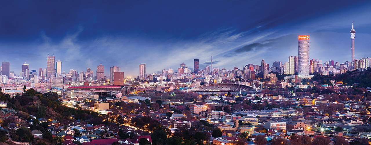
Woolpert was commissioned to undertake aerial lidar, A3 digital orthophoto imagery, oblique imagery, rendered 3D building models, and building footprints for the Johannesburg metropolitan area measuring 2,950 square kilometres. The project team previously provided aerial imagery coverage of the Soccer World Cup Stadiums and the full metropolitan area to assist with property valuations.
Challenge
Johannesburg is the largest metro municipality in South Africa. All departments and functions require geospatial information for effective managing and decision-making. The City Planning Directorate identified transport corridors, economic growth nodes, and district redevelopments that required 3D modeling with GIS integration and visualisation. The city chose the team's advanced 3D datasets and K2Vi visualisation software to meet these needs.
Solution
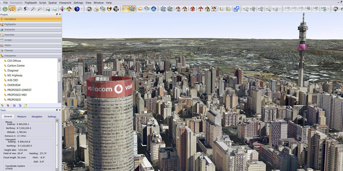
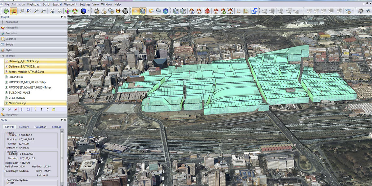
The project team created 3D building models at two levels of detail. The CBD areas were captured by aerial survey to provide the geometry and detailed textures to create fully rendered 3D building models at LOD3. Beyond the CBD areas, building footprints were digitised from the newly created digital orthophoto imagery. Height attributes were assigned to each building footprint, calculated from the ground and non-ground lidar datasets. The height attribute allowed simple building shapes to be extruded to their derived height attribute, thereby creating models at LOD2.
The supplied software allowed users to visualise the buildings and other GIS layers. The building models were created using the accurate and high-resolution lidar derived from a digital elevation model and the digital orthophoto base mapping. The 3D models, transport corridors, cadastral parcel data, and other layers were added. This allowed users to visualize the city and conduct highly interactive simulations like fly-through and what-if scenarios.
Results
The team's solution used multiple sources of data captured in different ways. We also enabled the use and viewing of oblique imagery which provided the geometry and textures for the CBD building models.
Similarly, the aerial lidar provided detailed DEMs for contouring and input to the orthophoto generation. The lidar datasets also provided a derived height that could be used to extrude building footprints which in turn were digitised from the digital orthophoto dataset. The 3D data was used to build fully rendered 3D building models for GIS users in the various directorates in Johannesburg.