3D Scanning, Surveying and UAS Services
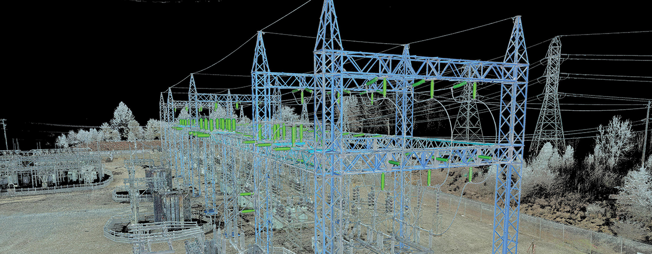
Woolpert is providing a variety of geospatial services to electric utility clients across the country. Leveraging innovative technologies with decades of practical experience, Woolpert is helping clients document, map and visualize projects prior to, during and after construction.
- 3D laser scanning: Efficiently, cost-effectively and safely documenting existing conditions and creating as-builts of electric substations with 3D laser scanning and 3D point cloud modeling
- Surveying: Using fully robotic total station instruments to generate right-of-way and construction staking plans; conducting as-built surveys to identify deviations from design coordinates
- Unmanned aircraft systems (UAS): Assessing and monitoring construction of a crucial system station using UAS; providing aerial photography, videos, point clouds, topography and other attribute data