Aerial Mapping Enables Management of South Australian Floodplains
Background
Southfront is a civil engineering company specialising in surface water, stormwater, and floodplain management. Based in South Australia, they deliver sustainable engineering solutions that help build more resilient communities for Renewables, Resources, Energy and State and Local Government clients Australiawide. Southfront engaged Woolpert as their spatial information partner, harnessing geospatial insights to enhance the quality, accuracy and timeliness of their deliverables.
Challenge
With a remotely located project area, Southfront needed a quality and rapid solution to support the delivery of floodplain mapping. This involved development of hydraulic models of creek and river systems at a range of scales and model outputs in the form of GIS-based mapping. Southfront required a project partner with a genuine understanding of the data requirements and the clients’ needs. The supplier needed to meet stringent requirements for accuracy, quality, and availability to support efficient operations and quick turnaround times.
Solution
Southfront engaged Woolpert to deliver aerial lidar the remote area of interest. Woolpert’s fixed-wing aerial fleet is strategically positioned, and equipped with industry leading sensors, to enable increased productivity through swift data delivery. The survey outputs were key to defining Southfront’s own program, to deliver on time and in-line with project goals.
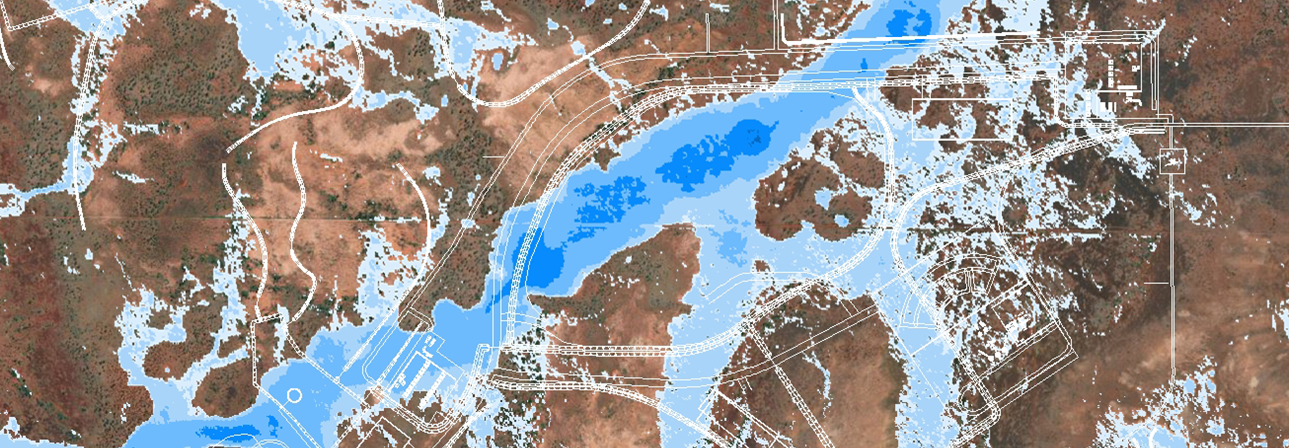
Results
Through the data captured by Woolpert’s aerial survey program, Southfront confidently developed their proposed solution, deliverables and recommendations on how to manage risk on site. These datasets were a vital component in the delivery of flood mapping assessment and ensured client timelines were met.
Client
Southfront
Location
Adelaide, South Australia
Purpose
Southfront engaged Woolpert as their spatial information partner, harnessing geospatial insights to enhance the quality, accuracy and timeliness of their deliverables.
Solution
Aerial Lidar
Benefits
- Reliable access to remote sites by dedicated aerial fleet and quality sensors
- Productivity increased through swift data delivery and quick turnaround times
- Risks mitigated by using the latest spatial data to build accurate hydraulic models
Additional Information
Natural resources and renewables