AFSOC ACC Installation Aerial Imagery and Lidar Data Collection (Phase III)
Purpose
In FY 2016-17, the Woolpert team provided geospatial data acquisition and production services, as well as related training, in support of the Installation Geospatial Information & Services (IGI&S) (GeoBase) programs at Hurlburt Field and Langley AFB and under the direction of the Geospatial Integration Office.
Solution
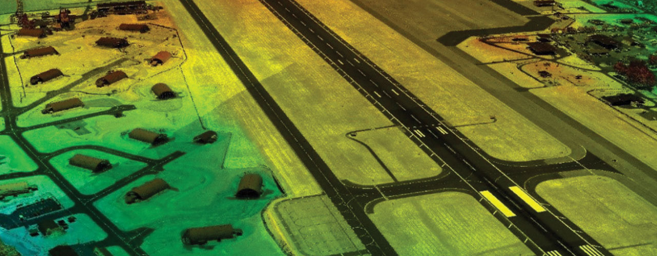
The scope of work included the airborne collection and processing of new orthoimagery and lidar data for nine U.S. Air Force major commands at 48 locations around the world. Working with the host nations to fully understand the regulations and laws as they pertain to imagery collection over international airspace, Woolpert provided up-to-date airborne imagery and geospatial data for over 7,038 square kilometers.
Outcome
The data collection included new 4-band (RGB/NIR) digital orthophotography at 7.5 cm pixel resolution and lidar at a nominal pulse spacing (NPS) of no greater than 0.35 meter (8 PPSM) or 0.7 meter (2 PPSM) over each installation. The team migrated flood determination, line of sight and airfield obstruction analysis into a seamless enterprise database. In addition to the airborne data, Woolpert provided a hands-on, instructor-led course on point cloud assemblies using data deliverables from the contract, as well as a separate vendor-led course on new products and capabilities.
Benefits
The imagery and feature extraction data provided the installations’ airmen, along with Woolpert’s onsite team, with the ability to analyze the installations’ current GIS vector data, such as utility and real property features, and to correct the data to higher positional accuracy using CADD and GIS platforms. The data feeds the Common Installation Picture (CIP)—a critical component in achieving geo-integration of information cross-functionality.
Client
U.S. Air Force Special Operations Command
Location
Worldwide
Purpose
Support IGI&S GeoBase programs
Solution
Airborne data collection and processing
Services
- Aerial imagery
- Lidar
- GIS
Benefits
- Accurate data
- Enterprise database
- On-site training
Additional Resources