EALP—BOEING FIELD
Project Details
CLIENT
Mead & Hunt, Inc.
LOCATION
Seattle, WA
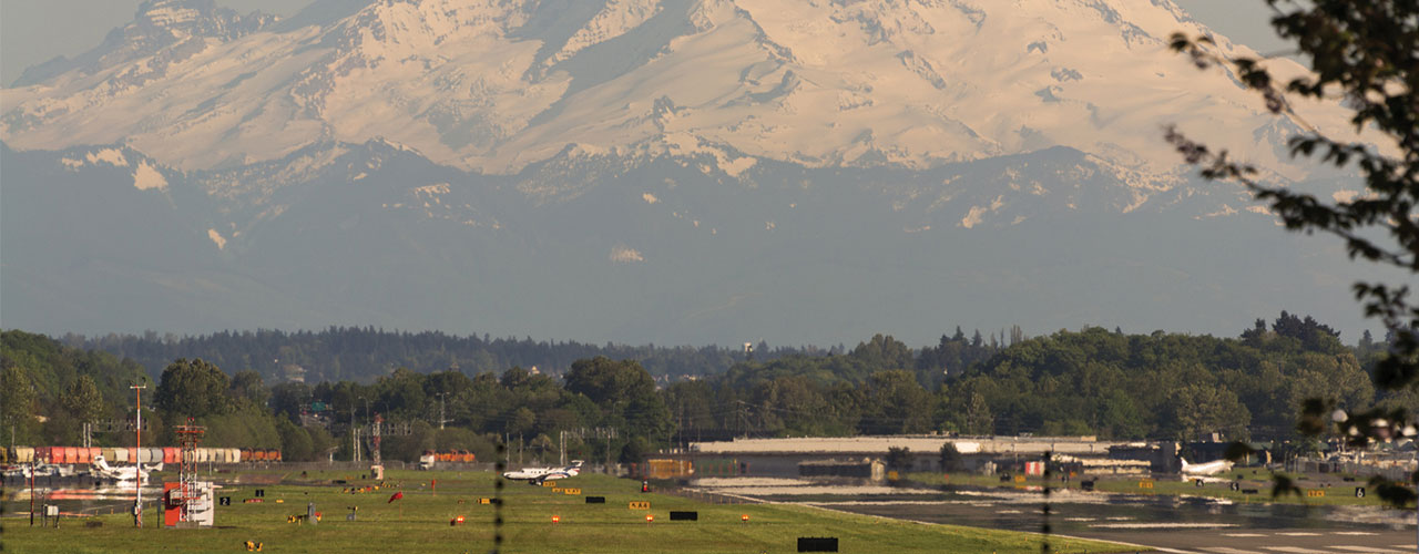
Boeing Field Airport (BFI), located just outside of Seattle, is a relatively small airport—but with big clientele. Home to significant executive jet operations for several global companies, BFI also supports Boeing aircraft production, cargo operations and limited commercial service to Victoria, BC. The airport’s unique layout and land constraints posed technical challenges for the airport’s development of a master plan and an FAA-required aeronautical survey.
As part of the Mead & Hunt team, Woolpert was tasked with preparing an electronic airport layout plan (eALP) and upgrading BFI’s geographic information system (GIS) database. The project team completed the following main tasks, with all results meeting National Map Accuracy Standards:
- Vertically guided instrument approach survey
- Flight planning to collect aerial imagery
- Aeronautical surveying
- Aerial triangulation
- Obstruction analysis
- Digital terrain model production
- Cartography contour processing
- Digital elevation model production
Woolpert submitted the compiled, final deliverables to the FAA and the airport’s AGIS web portal in Esri’s ArcGIS geodatabase format. The orthophotography, critical safety data, imagery acquisition report (including stereo imagery) and geodetic control report were delivered to the FAA, National Geodetic Survey and Mead & Hunt.
As a result of Woolpert’s efforts, BFI now possesses a significantly improved airport GIS database capable of supporting day-to-day operations and meeting all FAA reporting requirements.