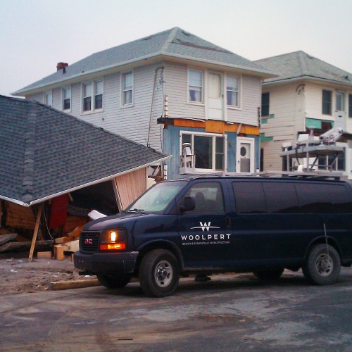
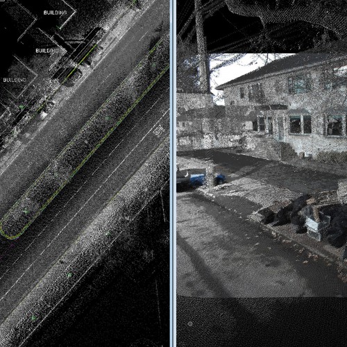
Hurricane Sandy Lidar Acquisition
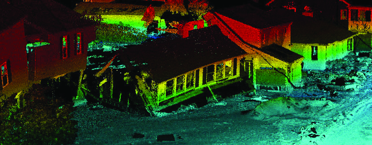
Woolpert acquired lidar data for over 250 square miles of coastline in New York, Virginia and Maryland affected by Hurricane Sandy (through task orders under existing USACE and USGS contracts). Along the southern and eastern coasts of Long Island, NY; Assateague Island, MD; Assateague Island, VA; Tangier Island, VA; and from Cape Henry to Willoughby Point, VA, Woolpert used a Leica ALS70 lidar sensor to acquire and provide topographic elevation data. We also conducted positional accuracy surveys and created digital elevation models from the lidar point clouds. The data was used by the USACE to visually evaluate, denote and quantify hurricane damage areas, change detection, and remediation.
Under the USGS task order, Woolpert performed an aerial lidar survey of Fire Island, NY, immediately following Hurricane Sandy’s landfall. The tide-coordinated lidar data acquired along Fire Island’s southern coastline was post-processed and delivered to the USGS within 48 hours.
Client
United States Army Corps of Engineers (USACE) St. Louis District and United States Geological Survey (USGS)
Location
Eastern U.S. coastline through Maryland, New York and Virginia