Lachlan River Bathymetric Survey
Background
The Lachlan River is part of the Murray–Darling basin. It flows through the Southern Tablelands, Central West, and Riverina regions of New South Wales, Australia.
The river rises on the western slopes of the Great Dividing Range, formed by the confluence of Hannans Creek and Mutmutbilly Creek, 13 kilometres east of Gunning, and descends 632 metres over its 1,440-kilometre course. The social ecological systems of the Lachlan River and its catchment include its upper tablelands and mixed farming slopes through to plains, rangelands, and lower floodplains. More than 100,000 people live in the Lachlan catchment. It is estimated that 12% of the state’s agricultural businesses are located within the catchment.
The Department of Planning and Environment (DPE) is actively involved with managing water for the environment in the Lachlan River system on an ongoing basis. As part of that role, they identified a need for up-to-date topographic information on the riverbed. DPE engaged Woolpert to conduct a bathymetric survey of portions of the bed of the Lachlan River and adjacent creeks.
Challenges
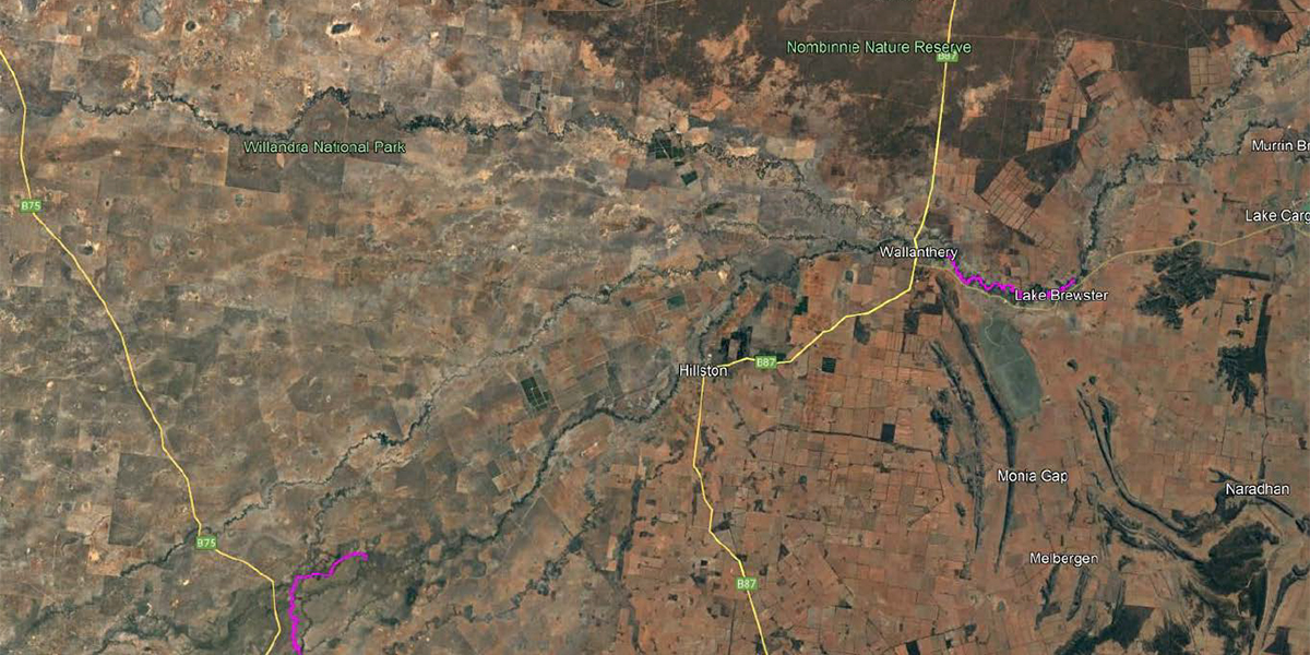
The primary scope of work was the capture and delivery of topographic data for portions of the bed of the Lachlan River and Torriganny Creek waterways in Booligal Weir Pool (16km), Torriganny Creek (41km), Brewster Weir Pool (15km), and Willandra Weir Pool (20km). The Lachlan River bathymetric project provided the following challenges:
Conducting survey work in a safe & sustainable manner
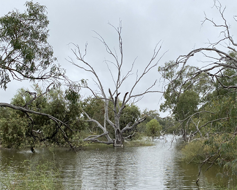
The survey work in remote regions of Riverina faced challenges in accessing the river due to high water levels, shallow and densely vegetated margins, fallen trees and debris. The survey work required a detailed plan for transportation and logistics and working with property stakeholders, and involved moving the surveyors and equipment multiple times to different states and locations.
The project was guided by the Safety and Environment Management Plan to ensure the health and safety of personnel and minimal impact on the natural environment. The team used remote control vessels as a low-impact survey tool and took precautions to reduce human footprint and minimise impact on the local ecosystem.
Working in a remote area and connecting with the local community
Conducting survey work in the remote regions of the Riverina necessitated having a detailed plan for transportation, logistics, and working with property stakeholders. This included moving surveyors and equipment multiple times between different states and survey locations up to 100 kilometres apart. Limited fuel stations, suppliers, and service facilities meant project teams needed to follow a strict schedule to avoid service interruptions. The project management team also developed comprehensive field resources, including supply locations, emergency contacts, and liaising with property stakeholders to effect access to the river and adjacent properties.
Solution
The field survey commenced on 9 April 2022 and concluded on 4 June 2022. Survey control was established primarily from state survey marks sourced from the New South Wales Spatial Information Exchange Map (SIX Map) Survey Control Information Management System (SCIMS). SCIMS was searched for suitable marks along the river corridor, favouring marks with a quality AHD height.
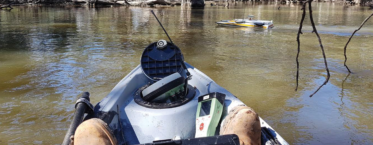
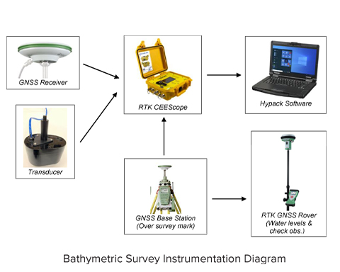
The surveying team used a bathymetric survey system with six components (GNSS receiver, transducer, CEEScope, laptop, RTK GNSS base station, and RTK GNSS rover) to measure their autonomous position, calculate correction, measure positions of survey marks and water levels, and check river cross-section information. The system was set to transmit RTK corrections to the river and boat, and the base station was set to record static GNSS data. A log sheet was completed and photos were taken to confirm the details of the setup.
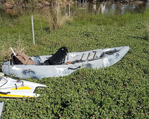
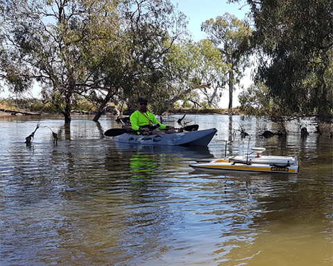
Due to shallow waters and densely vegetated banks, most surveys were conducted using an Accura remote-controlled bathymetric survey vessel, which was easily launched and retrieved due to its shallow draft and ability to be carried by two people. The field team also used two kayaks to assist with the field capture due to difficulty accessing the side of the river due to high water levels.
Results
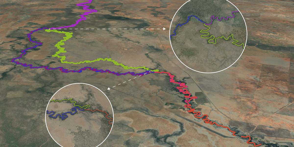
For the duration of the project, water levels were the highest they could be without severely impeding the work. While these conditions introduced some challenges to surveyors, they were optimal from the client’s perspective and enabled delivering critical geospatial data for DPE. The field team and equipment performed very well and quickly covered the river while property stakeholders greatly assisted in facilitating access to the river. The captured survey control and bathymetric data were found to be quite consistent and thorough, with very few unanticipated gaps. The final data deliverables represent the successful survey of some 92km of Lachlan River and Torriganny Creek.
The DPE intends to use this information to develop a hydraulic model for the Lachlan River and floodplain to inform the management of water for the environment in the Lachlan catchment.