MOTCO Real Property Master Plan Update, Aerial Imagery and Surveying Support
Challenge
The Military Ocean Terminal Concord (MOTCO) needed an updated real property master plan to more effectively meet its mission.
Solution
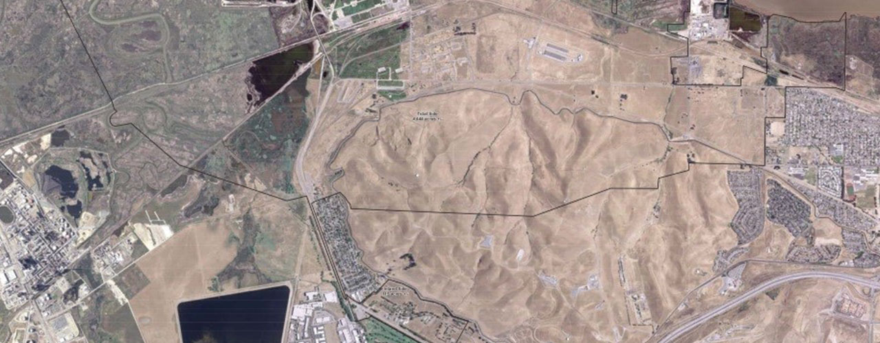
The team provided boundary surveys, orthophoto imagery, airborne lidar and related geospatial data services that included establishing a geodetic control network suitable for the MOTCO site boundary survey and aerial surveys. Woolpert also performed courthouse research, field reconnaissance, data reduction, boundary resolution, calculations and aerial mapping and field-tied existing property and control corners and set final corner monuments for the entire MOTCO property boundary.
Outcome
The team acquired and processed aerial imagery at a 3-inch pixel (1”=50’) resolution and used it to develop color digital orthophotos with aerial triangulation reports. To support the development of 1-foot contours and breaklines for digital terrain models, the lidar data was acquired and processed at a nominal pulse spacing of 0.7 meters (2 PPSM) over the entire 4,500-acre installation. The team provided accompanying FGDC-compliant metadata, collection parameters and accuracy. We delivered a final comprehensive report that contained a detailed narrative for datum documentation, control and data acquisition, and adjustment results, as required.
Benefits
The geodetic control network is suitable for future design and construction surveys for the entire MOTCO installation, and it conforms to NGS and appropriate engineering manual standards.
Client
Military Ocean Terminal Concord
Location
Concord, CA
Challenge
Outdated real property master plan
Solution
Update plan with surveying and aerial imagery
Services
- Aerial photography
- Lidar
Benefits
-
Accurate geodetic control network