Petrochemical Complex Surveying and Mapping
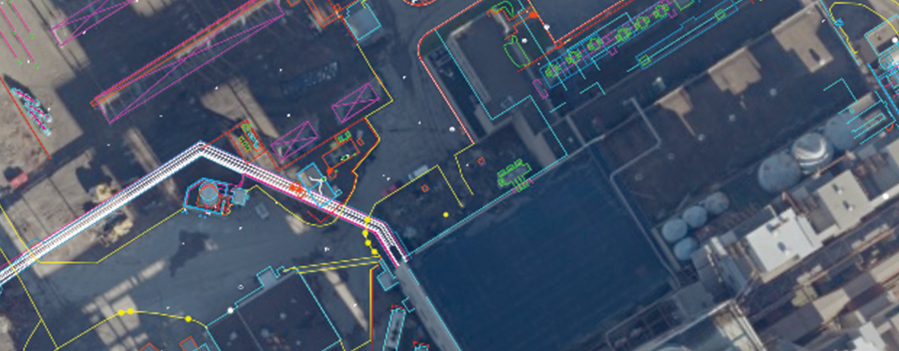
Woolpert provided top-notch surveying and mapping services as part of a geophysical project at a small unincorporated community along the Ohio River. Woolpert completed the following surveying and mapping services for the 450-acre petrochemical complex:
- Established project survey control points
- Mapped property boundaries
- Located ecological and environmental delineations
- Conducted a bathymetric survey of existing ponds and the Ohio River shoreline
- Marked exploration locations
Woolpert also provided photogrammetric mapping services, including the collection of 3-inch resolution, color digital orthoimagery and digital planimetric mapping with 6-inch contours. As a final service, Woolpert performed quality level C subsurface utility engineering and sub-bottom profiling.