Surveying Support for the Port of Vancouver
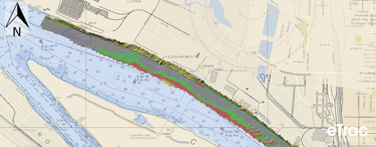
Located on the north side of the Columbia River in Vancouver, WA, the Port of Vancouver is one of the largest ports on the Columbia/Snake River system. In support of operations at the Port, Woolpert has provided annual conditions surveys and dredging support. The multibeam bathymetry data from the surveys is used to produce high precision navigational charting products for the Port and Columbia River pilots. These navigational charts help pilots safely navigate in and out of the Port and track known obstructions in the area. Woolpert produces an interactive geospatial database for the Port to host data products such as depth, high resolution imagery, dredge boundaries, and features/obstructions in an online environment.
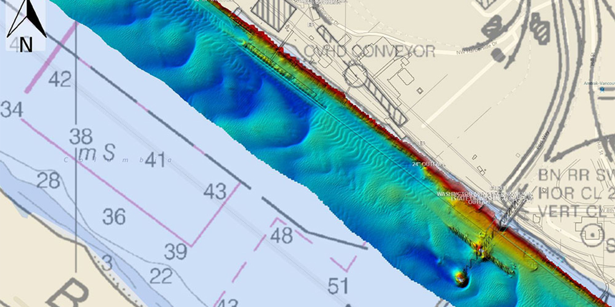
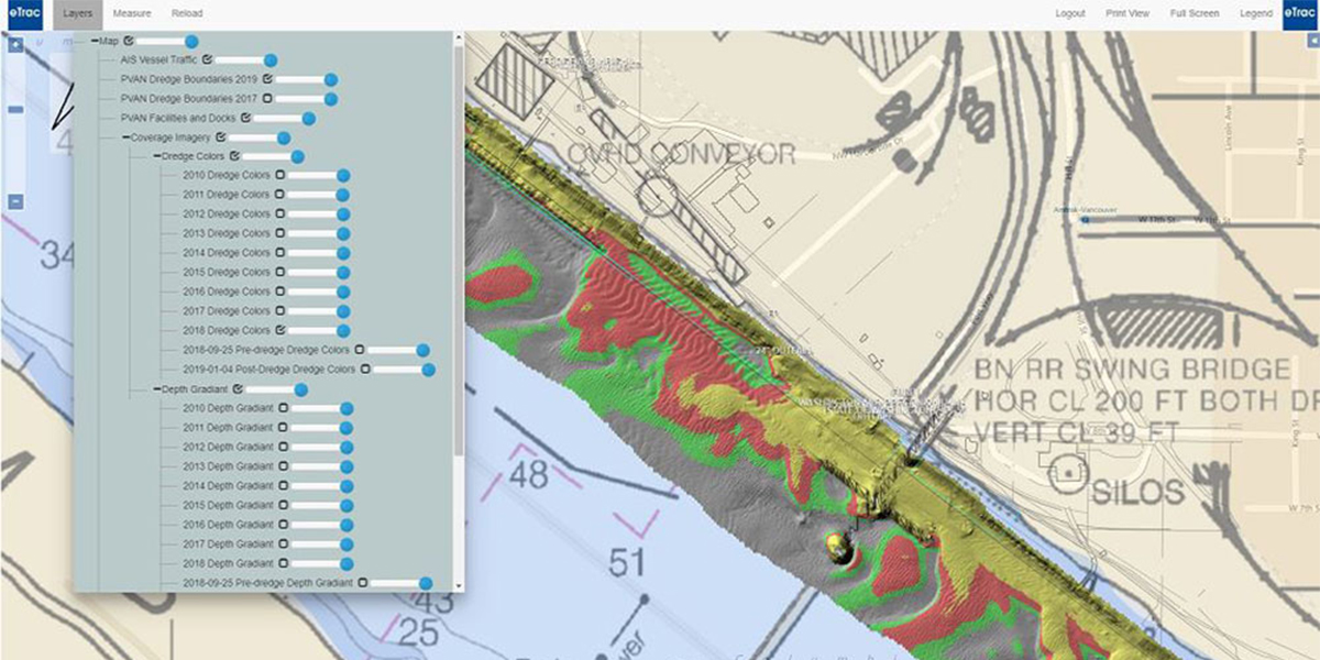
Woolpert has delivered a custom web-based geodatabase that includes layers such as the survey boundaries and the annual bathymetric data colored by depth and dredge-depth specifications. It also includes labels and boundaries for Port facilities, docks, and live AIS vessel tracking.