ROADWAY ASSET INVENTORY—INDIANAPOLIS
Project Details
CLIENT
City of Indianapolis Department of Public Works (DPW)
LOCATION
Indianapolis, IN
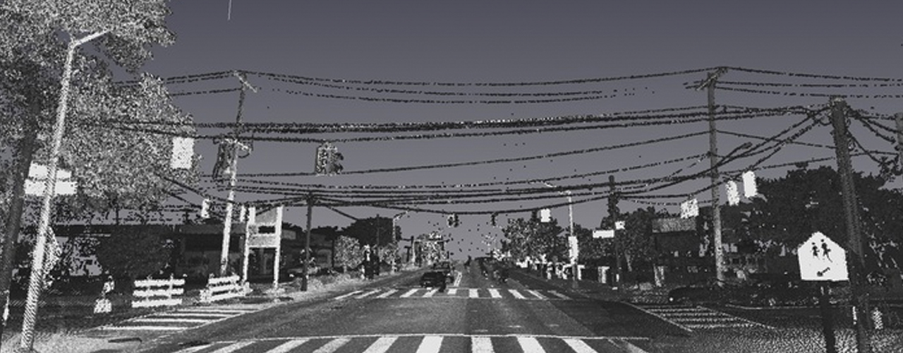
Woolpert was contracted by DPW to develop a documented sign replacement program by creating a model and physical database repository for all sign inventory data. Without causing any disruption to the motoring public, Woolpert drove approximately 3,300 miles of the city’s street centerlines and collected imagery and lidar point cloud data. Woolpert used an in-house mobile mapping system (MMS) to efficiently acquire roadway asset information from across the city; the collection included a full sign inventory, curb and sidewalk assessments, and roadway pavement condition index (PCI) and International Roughness Index (IRI) surveys.
The project team input the MMS imagery and point cloud data into a proprietary, semi-automated, sign recognition application for processing and evaluation. Using a web-based quality control viewer, Woolpert evaluated various curb and sidewalk distresses and assigned each asset a condition rating based on a predetermined point scale.
The Woolpert team then used semi-automated collection and interpretation processes to perform the PCI survey of over 2,200 miles of Indianapolis residential roadways and IRI survey of over 3,200 miles of roadway within DPW jurisdiction. Image rating software enabled Woolpert pavement inspectors to evaluate the collected images and identify visible pavement distresses. Processed and quality-controlled data was then imported into DPW’s existing MicroPAVER database.
This large-scale effort, the first of its kind in the nation, featured the development of cutting-edge, semi-automated feature extraction techniques and the innovative application of condition rating methods.