BLOG
—
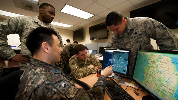
Growing a Geospatial Information Culture in the DoD: Part 1
Written by Dr. Brian Cullis
Have you ever had a great idea pop into your head about how geospatial technology could be leveraged in new ways by your organization or a client?
Usually these ideas arise in the minds of geospatial professionals as they encounter the challenges faced by technicians, managers or executives. Connecting these challenges to geospatial information and services (GI&S) results in better products, processes and informed decisions.
Inspired uses of GI&S also come from those with expertise outside of the geospatial discipline who see how geographic information systems (GIS) can combine and analyze multiple data sources in new ways to achieve breakthroughs for virtually any discipline.
Innovators usually begin with examining how geospatial technology can benefit end users. Literally, they begin with the end in mind. In his 1989 best-seller, “The 7 Habits of Highly Effective People,” author Stephen Covey described how such inspirations are created twice; first mentally, then physically in the form of blueprints that outline the process needed to bring the idea to life.
But how do you progress that idea to real-world implementation and achieve the desired end state? What specific actions are needed? What changes will be required? Who will be willing to lead or invest in such a change agenda? Will others be willing to change their own behaviors? The questions are endless.
And, what if the idea led you to realize that your vision would only be possible if you found a way to create an entirely new geospatial information culture within the largest U.S. federal organization—the Department of Defense?
Q: A geospatial information culture… Hmmm. Like an enterprise GIS?
A: No, more like a geospatial enterprise.
Q: What’s the difference? Seems like semantics.
A: I’d offer there’s a BIG difference.
Check out my next blog to discover the difference.

Brian Cullis, Ph.D.
Dr. Brian Cullis has more than 30 years of experience working in a geospatial information resource leadership position. Through both active duty and private sector careers, he has helped organizations build effective strategies for organizing and delivering enduring geospatial IT capabilities, starting with the USAF GeoBase Program in 2001. Brian’s drive for continual improvement has been integral to the development, sustainment and enhancement of GI&S capabilities in DoD beyond the battlespace.