BLOG
—
2022 Esri User Conference: Reset in San Diego
But “42nd occurrence,” while factually accurate, is a bit of a misnomer when referring to this yearly event. In 2020 and 2021, the UC succumbed to digital sessions and virtual meetups in place of the conference as the world attempted to understand, fend off and eventually rebound from COVID. Interesting to note that the last in-person, pre-COVID UC had swelled to 20,000-plus attendees—which is not only a far cry from the UC’s humble beginnings of 11 attendees but also a massive number for the industry today. Attendance figures this year were broadcast to be roughly 15,000 strong, which is still impressive, especially given two years of stability-shattering unknowns. But back to the idea of a reset, it did feel great to again arrive in San Diego on a sunny Sunday in July and be greeted by familiar places and faces, all ready to engage and grow as an industry.
The UC seemed to have a sense of contentedness this year. It felt like a healthy step forward from the Esri Partner Conference (EPC) in March, which was abuzz with an almost unnatural sense of excitement—people were finally going somewhere, to meet with others, actually in person. Thankfully, it seems that the pent-up anxiety from two years of limited interaction has been replaced with genuine appreciation for merely being together. That may sound overly quaint, but from the plenary through the flight home, attendees exhibited a relaxed air of comfort to be together and move forward as an industry.
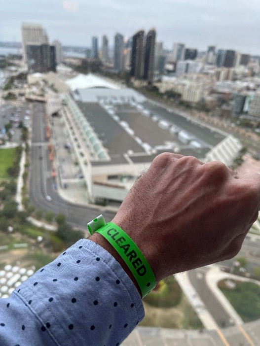
All attendees had to be COVID-free, as evidenced by this armband, to enter the sprawling San Diego Convention Center.
Some observations on the conference itself:
- The plenary keynote speaker was David J Hayes, who is special assistant to the president for climate policy. Hayes focused on 1) addressing climate change, 2) our transition to a green economy and 3) climate resilience. While Esri conferences traditionally highlight environmental and societal concerns, this keynote was uncharacteristically attentive to current energy, environment, and infrastructure polices and funding. But given that the UK set its highest temperature ever a week after the UC (104.5 degrees!) and more than 1,700 people have died in Portugal and Spain alone during this summer’s heatwave, this topic likely deserved top billing.
- While the keynote addressed serious subjects head on, the conference also showcased a wide variety of technologies and use cases. One of the more unique was the use of ArcGIS Velocity to predict the absolute worst time to drive in New York City. Take note New Yorkers and avoid the roads at 2 p.m. on Saturdays.
- OpenStreetMap’s new 3D Buildings and Trees data service was referenced throughout the conference. It is pretty wild to have a free, 3D dataset for the entire planet that is updated monthly.
- Digital twin/duplicate has received top billing in industry conferences over the past couple of years and that trend continued at the UC. While it’s no longer the mysterious, emergent technology of a few years ago, its promise is gigantic and readily digested. It provides invaluable perspective and increased capabilities to our natural and built environment and can be employed on multiple scales to support a wide array of industries.
- There is an unbelievable amount of impressive geospatial technologies to learn about during the UC, but in my opinion, the standout technology of the conference was ArcGIS Knowledge. Esri’s integration of graph analytics with the ArcGIS platform was very compelling. Graph analytics expose underlying relationships in data that create impactful visualizations before the data even hits the map. The combination of data relationships and spatial analyses could have massive implications for supply chain, resource consumption and undiscovered applications for our evolving, interconnected world.
- Woolpert is a Gold Esri Business Partner, and my co-workers and I experienced tremendous collaboration with Esri throughout the week—both within and outside the conference center. Thank you to Esri’s Clay Starr and Jessica Valenti for being such gracious hosts. From technical mind shares to collaboration in specific verticals and geographies, we are excited about our continued alignment with Esri across the architecture, engineering and geospatial (AEG) industry.
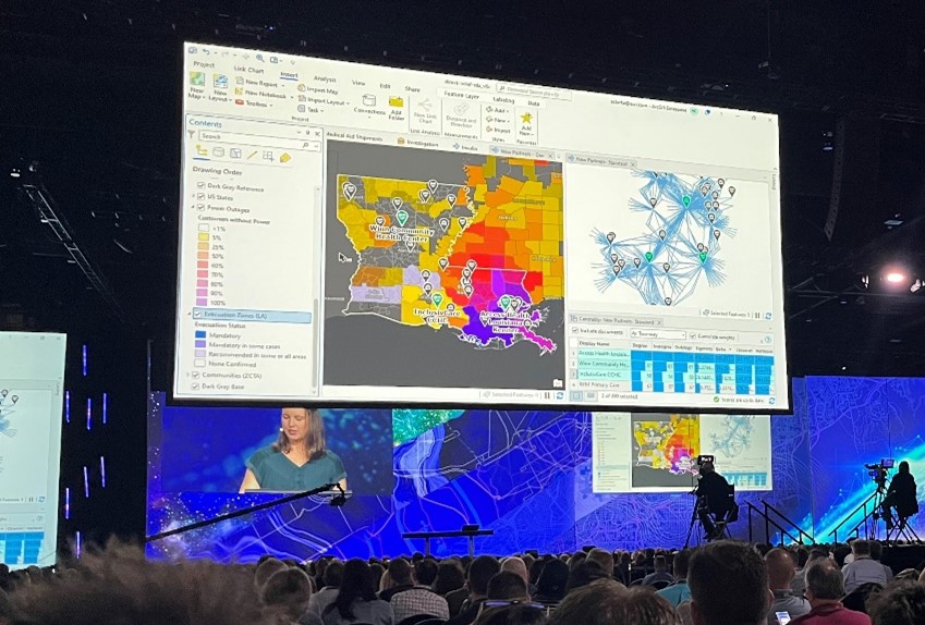
ArcGIS Knowledge was one of the most intriguing technologies discussed at this year’s User Conference.
- Lastly, my perspective has been shaped by years of UC attendance. For a “fresher” perspective, check out how our intern Shelby Malburg, a UC first-timer, saw the conference through her blog and video.
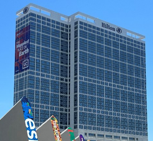
Look closely. Apparently, my hotel was the mappiest place on Earth.

Share this Post