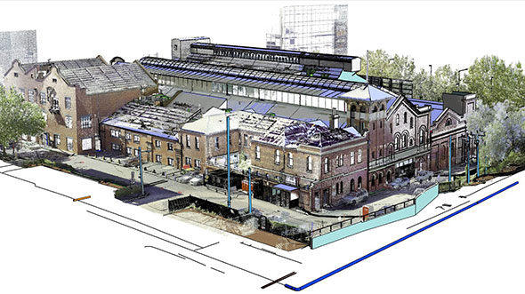
Geospatial Data Transforms the former Victorian Heritage Building

Background
The former Richmond Power Station stands as one of the oldest electric power stations in the state of Victoria, generating electricity supply from its inception in 1891 until it was decommissioned in 1976. Today, the heritage
building stands as a reminder of Melbourne’s technological innovation and the profound impact of the expansion of the electricity industry. The Naomi Milgrom Foundation has committed to the renewal and the reuse of the building as a mixed-use cultural innovation centre for the inner-city suburb of Cremorne. Woolpert was engaged as a long-term project partner to deliver multiple packages of work to support the delivery of the Richmond Power Station Renewal Project.
Challenge
The Richmond Power Station Renewal Project required detailed insights into the building’s structural information and heritage elements to support the design and planning works of the redevelopment. Throughout its operating life, the station underwent several stages of restructuring to meet the increasing demand for electricity, with this phased transformation recognised in the fabric of the building. The Naomi Milgrom Foundation and the project team sought a full-suite geospatial provider, able to deliver both accurate survey, CAD and Revit model outputs that could be used as a single source of truth for the project going forward.
Solution
Results
Woolpert’s full-service geospatial capability underpinned project work performed by the design team. The survey data forms the basis of all future works for the precinct, while also improving productivity, lowering costs, and protecting the heritage elements unique to the former Richmond Power Station.
Client
The Naomi Milgrom Foundation
Location
Melbourne, Victoria, Australia
Purpose
Woolpert was a long-term project partner, delivering multiple packages of work to support the renewal and reuse of the former Richmond Power Station.
Solution
• Scan-to-BIM
• Electronic Service Locating and Ground Penetrating Radar
• Title Re-establishment
• Point Cloud Survey and 3D Revit Modelling
Benefits
• Streamlined resourcing and project management achieved by a holistic approach to surveying, modelling, client engagement and delivery all through the one geospatial provider.
• Productivity and consistency maintained by engaging a long term project partner with advanced knowledge of the historic site.
• Critical heritage elements captured for the project team, to allow preservation of the site’s industrial aesthetic for the pleasure of future generations.