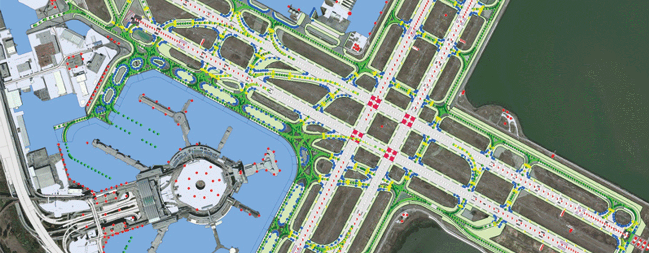
SFO Airport CAD/GIS Plan and Standards

Background
The San Francisco International Airport’s (SFO) enterprise GIS captures airport interior and exterior infrastructure information. In recent years, the airport completed a Federal Aviation Administration-sponsored airport GIS pilot project and has maintained the data according to FAA Advisory Circulars (ACs) 150/5300-16, 17, and 18. Woolpert has acted as SFO’s on-call GIS consultant since 2016; we previously had completed both and CAD and GIS standards, and the client needed to update a large amount of legacy data to make it compliant with these new standards.
Challenge
Building floor plan data required conversion and data maintenance workflows and procedures were needed to ensure the floor plans remained compliant with the interior standards and would be able to integrate new BIM deliverables from major construction. This legacy data came from many departments and consultants, and as a result, was often inconsistent.
Solution
The Woolpert team assessed existing business processes for as-built deliverables and design drawings, evaluated industry standards and compliance requirements, prioritized datasets, identified end products, and collaboratively established standards for each discipline. Once these tasks were completed, Woolpert proceeded to get these standards approved and published. A standards verification process that included both QA/QC guidelines and software automation was developed.
It was determined that SFO had a need for extract, transform, and load (ETL) software, which is a powerful tool that enables CAD-GIS-BIM data exchange, populates metadata, verifies contractor submittals, and coordinates other system transformations. ETL products will also provide SFO with automated QA/QC procedures along with rules-based checks on data development and deliverables. Spatial data types and flows currently used or desired were discussed, and Woolpert determined where the technology could best add value.
Outcome
To maintain the interior infrastructure, Woolpert converted all SFO building floor plan data and developed data maintenance workflows and procedures. Woolpert assisted SFO with the conversion of nearly 100 different datasets that were in a CAD environment. This process included:
- Updating CAD files to the newly developed CAD standards
- Creating areas from architectural floor plans
- Converting door blocks into GIS features
- Setting up feature services to synchronize the GIS data into a CAD environment
- Developing business processes to maintain and update the floor plans
- Training and transferring knowledge to SFO staff.
There were many challenges involved in meeting SFO’s goals for a go-live environment. This project required constant communication between multiple SFO departments and Woolpert and used Esri's AutoCAD for ArcGIS. Collaboration was streamlined using online tools for data submittal, approval, and change requests.

Benefits
SFO now has a consistent data model that can be utilized in ETL technologies to go between platforms. The maintenance of the facilities’ infrastructure is now streamlined and can be updated with mobile technologies. A combined Woolpert-SFO team provided significant training to additional SFO staff, enabling them to be self-sufficient in the updating and maintenance of interior data.
Client
City and County of San Francisco
Location
San Francisco, CA