SOLAR RESOURCE MAPPING
Project Details
LOCATION
Colorado and Ohio
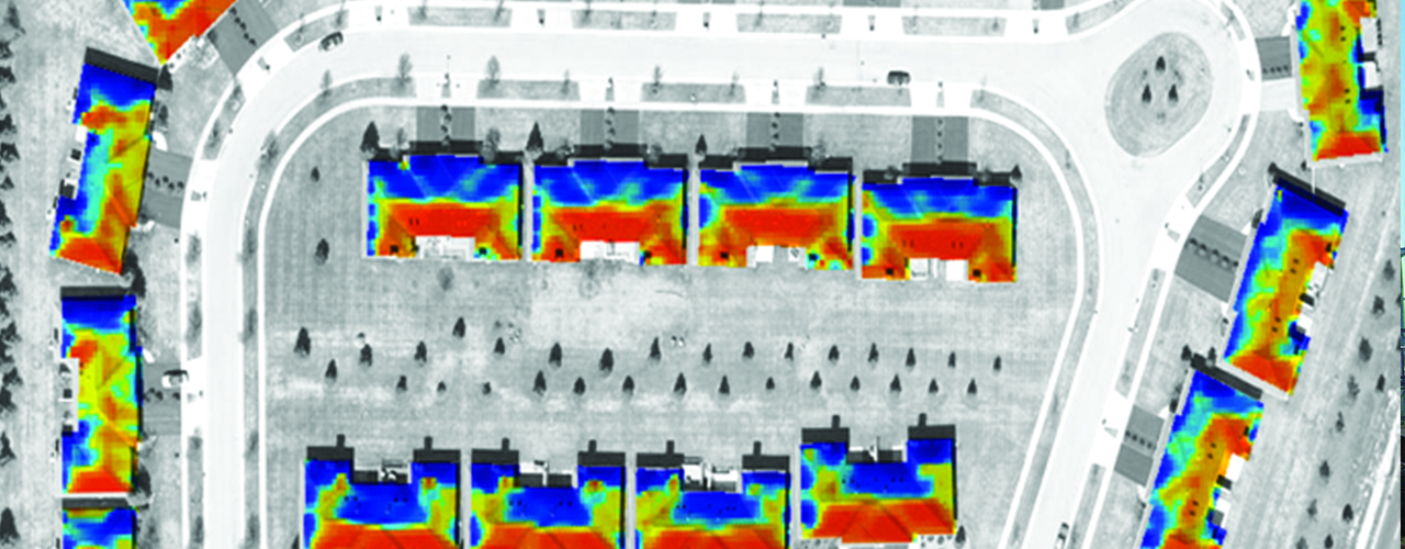
Woolpert produced innovative regional solar resource maps to help property owners in Colorado and Ohio calculate potential returns on photovoltaic investments.
Using previously collected lidar and imagery datasets, the Woolpert team extracted and measured hundreds of thousands of structures within the project areas. After calculating the hourly solar insolation received at each structure over a one-year time frame, Woolpert converted that data into interactive, web-based solar potential maps.
Residents, builders, developers and government officials use these online maps to search for properties, view solar potential points on a map, see the total and available rooftop areas, and finally, calculate estimates of potential annual output. This structure-specific data helps users more accurately estimate the cost efficiency of installing solar rooftop panels for alternative energy sources.