Services
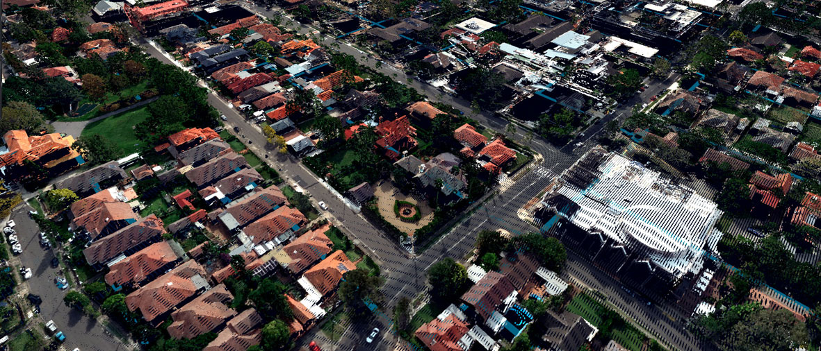
Aerial Survey
Woolpert delivers reliable aerial survey outputs, generated with state-of-the-art technology, backed by many decades of experience.
Our aerial technologies include topographic lidar and digital cameras allowing us to deliver orthomosaics and terrain data sets of large land areas quickly with resolutions ranging from 5 to 30cm. This means your assets are captured in incredible detail, enabling you to make better informed decisions.
Airborne Imagery Survey
Bespoke data you can rely on. Receive fit-to-purpose aerial imagery data and detailed, actionable insights, customised to your specific needs.
Aerial Lidar Survey
Actionable insights from data to spec, on time and within budget help you to make informed decisions faster with data you can rely on.
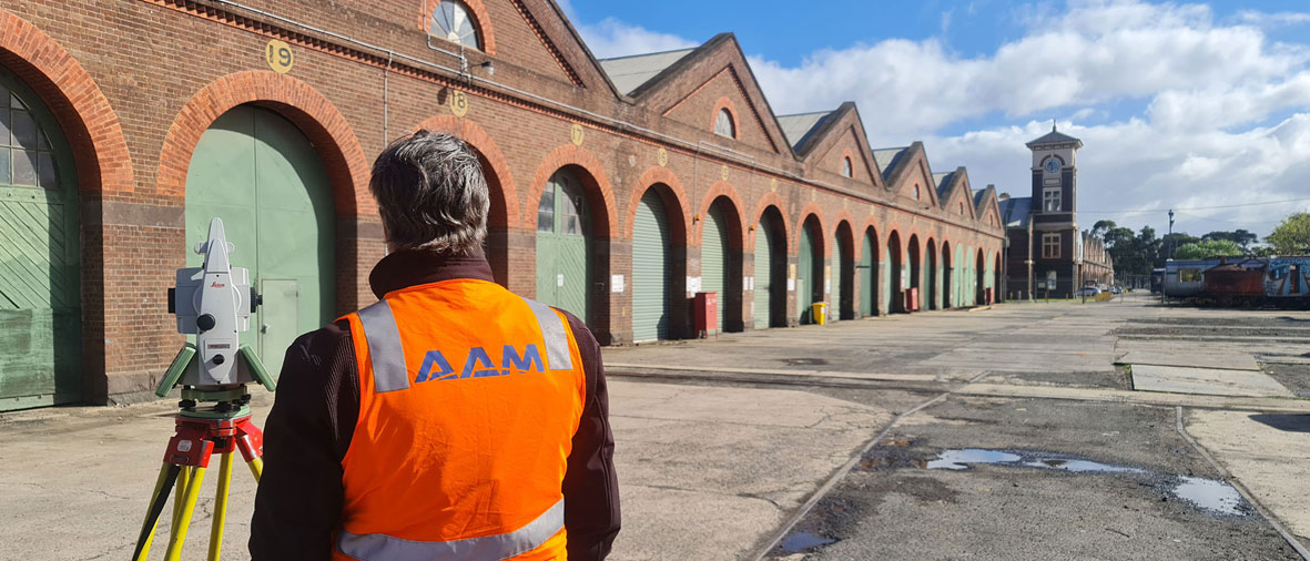
Land Survey
Woolpert has a proven history in providing land survey services that enable delivery of major projects.
With more than 60 years of experience providing consultancy survey services, we are a trusted advisor to government agencies, the construction industry, heavy industry, the resources sector, and land and property developers.
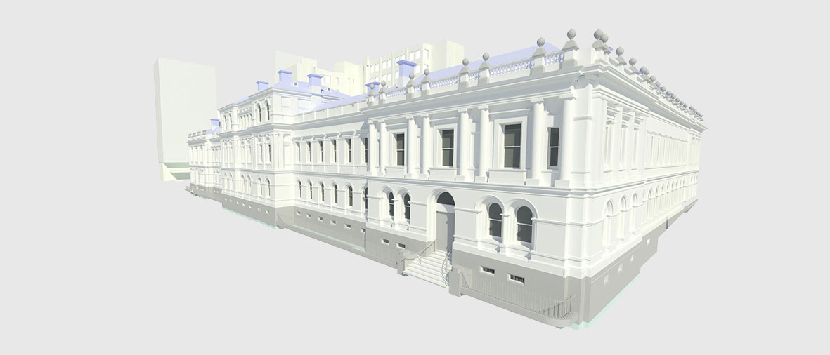
We deliver solutions including cadastral title definition, construction surveying, precise engineering surveying, structure monitoring programs, and site scanning. We’re also known for our 3D visualisation for detailed modeling of heritage buildings and industrial brownfields, as-built, and whole-city modeling.
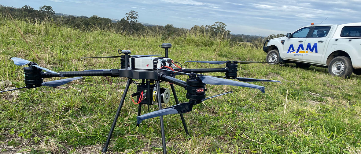
UAV Survey
We’re Asia-Pacific's leading UAV survey specialists. We deliver fast, accurate drone data that saves time and money.
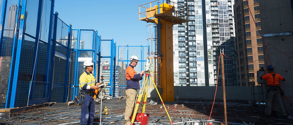
Construction Survey
Work from facts not assumptions. Woolpert delivers validated survey data, grounded in real-life measurements and locations, so you can make informed, data-driven decisions.
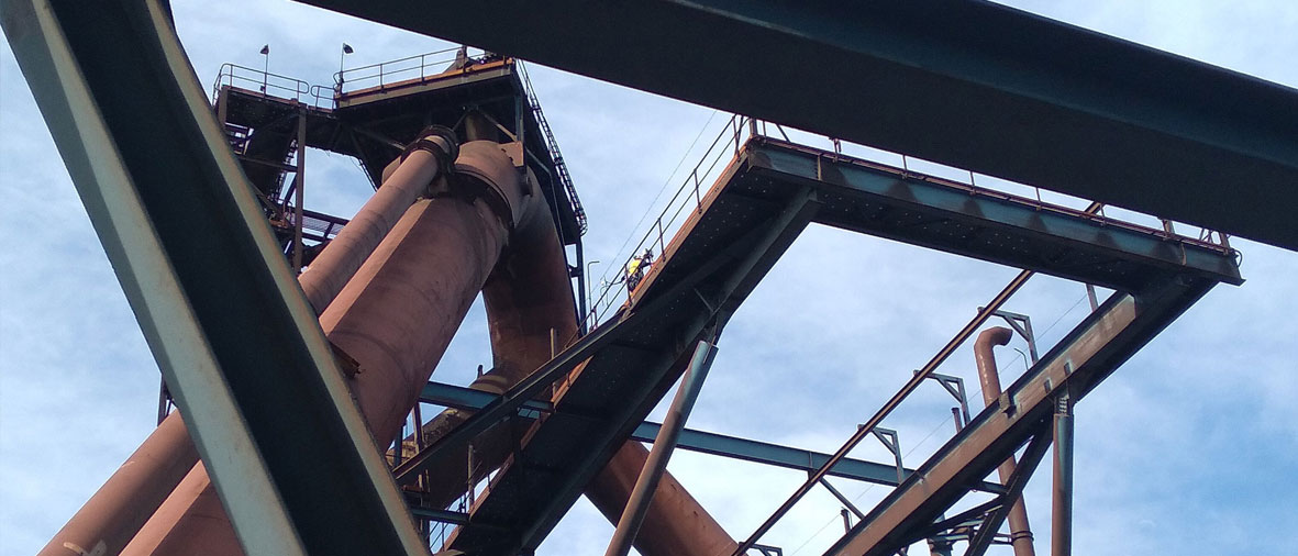
Monitoring Survey
Woolpert's monitoring survey services go beyond just providing the raw data. Our expert team of monitoring surveyors will help you understand the data so you can derive actionable insights from it.
Engineering Surveys
Our engineering survey service is defined by its expertise and speed. Backed by more than 60 years of experience, our team always strives to get you accurate answers in the shortest time frame possible.
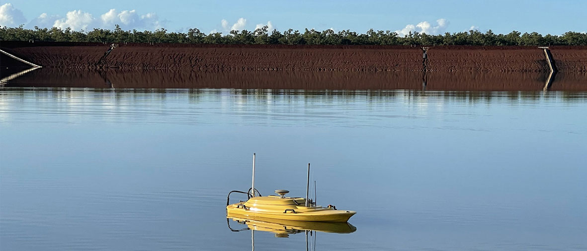
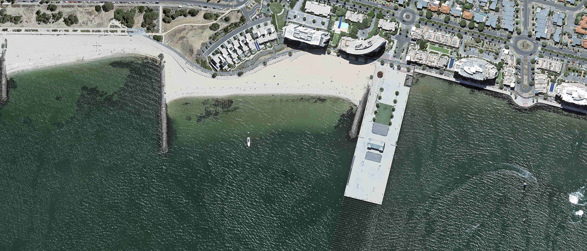
Bathymetric Survey
In underwater survey data and 3D modeling, Woolpert has built a reputation of providing accurate and informative data to engineers and scientists, helping them manage projects in and around bodies of water.
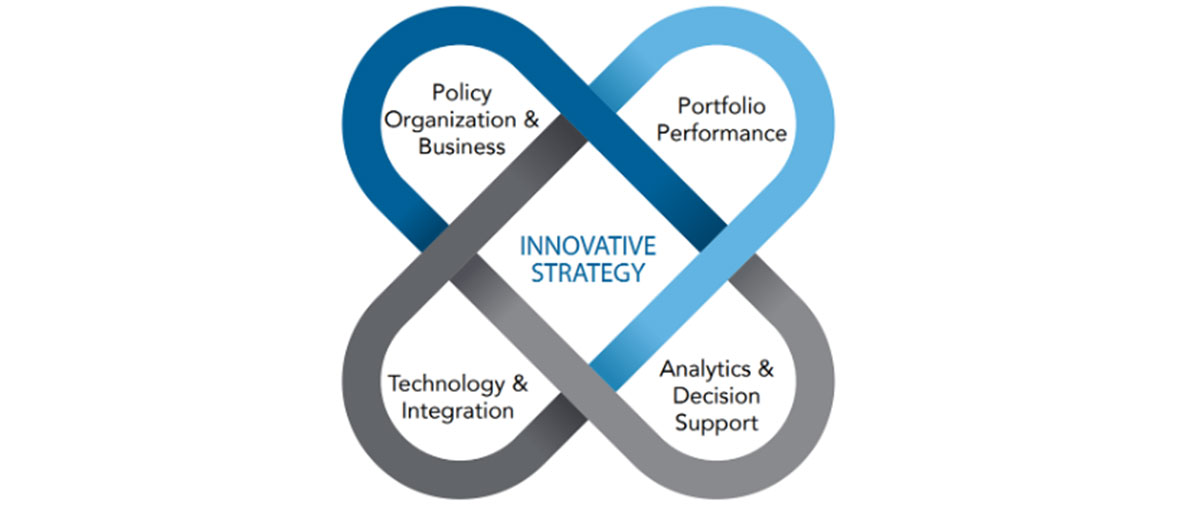
Technology Implementation Services
From the first planning steps through final decommission processes, Woolpert has a deep understanding of the full asset management lifecycle.
As a software partner and implementer, we deliver solutions that support sustainable, organisation-wide asset management across all lifecycle phases to keep your organisation better connected. Our experts work within international standards, providing best-practice deliverables and consulting to help you achieve organisational optimisation.

Geocirrus 3D Content
Woolpert has an extensive catalogue of 3D content. You can explore and purchase this content through the Geocirrus store.
Geocirrus is where quality spatial content and convenience converge. You can search, discover and purchase geospatial data from our easy-to-use portal.
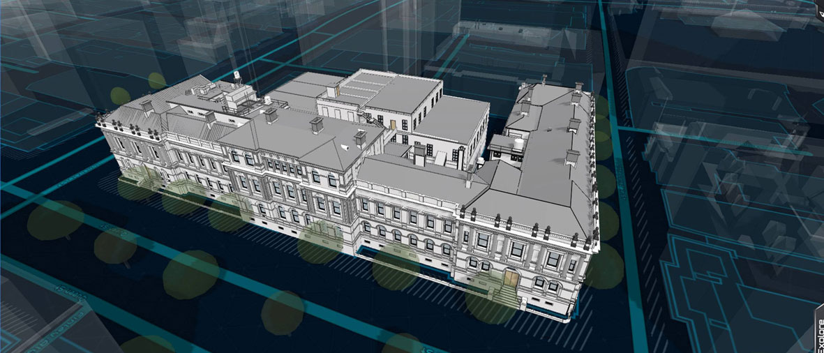
Laser Scanning, Modeling, and BIM
An early adopter and investor in laser scanning, 3D modeling, and BIM, Woolpert is an investment in your project’s success.
We employ these technologies to survey the current status of the built environment and to enhance future design, construction and ongoing management. You can rest assured that in partnering with us, you will receive high-quality data and service from an industry leader in laser scanning, 3D modeling, and BIM.
Modeling and BIM
Our experienced modeling team delivers quality, data-driven models you can rely on. Our functional, geospatially accurate solutions are a high-quality, fit-for-purpose, on-time, on-budget solution to better inform your projects.
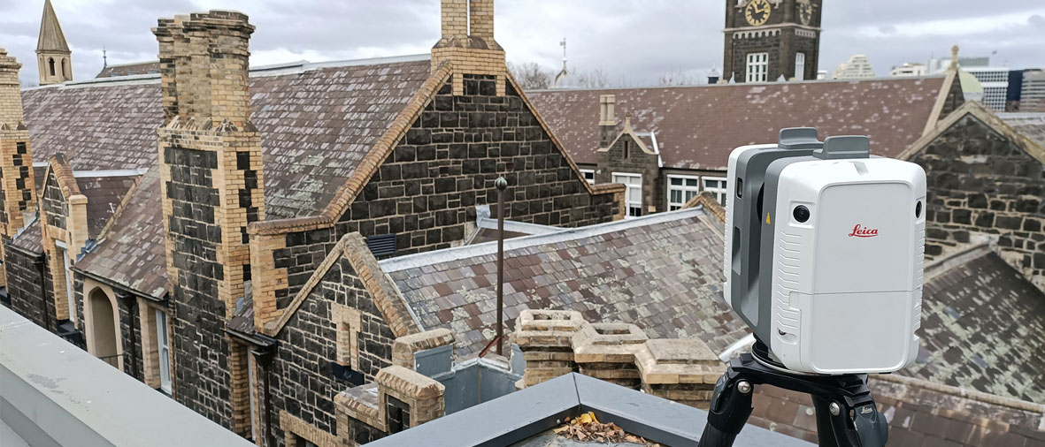
Laser Scanning
Reduce risk with accurate modeling and digital representations for your next project. Woolpert Asia-Pacific's reputation as trusted advisors in the field of laser scanning provides data-driven certainty to all your planning and design needs.
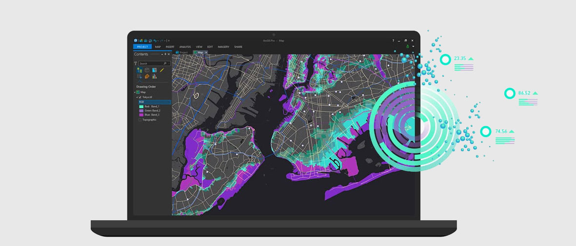
Geospatial Solutions
Considering geospatial information technologies or wanting to expand your usage? Woolpert can identify ways in which geospatial data, tools, and services can help your organisation achieve its goals.
We help organisations across all industries to implement best practices to integrate geospatial information into their business processes. The geospatial solutions we supply to you are the same ones we use at Woolpert. We know how well they work and our deep experience means we can make those tools deliver the insights you need.

Whether you’re a beginner or a more advanced user, our training courses will provide you with the knowledge and skills needed to get the most out of VertiGIS Studio.
We’re one of Asia-Pacific's largest ArcGIS experienced consultancies. Contact us for expert advice on how to make the most of your GIS technology.
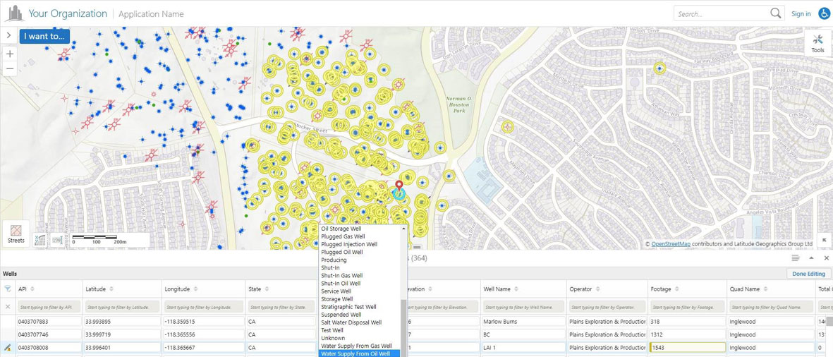
VertiGIS Studio Web Mapping
Manage your complex mapping needs with ease. Woolpert's Geocortex web mapping software saves you time and effort with its simple configuration and automated workflows.

Solution Architecture and Enterprise GIS Consulting
Our team can help you develop your geospatial strategy, GIS technology roadmap, and accompanying work plan. We help you implement best practices to integrate geospatial information into your business processes.

Expert Geocortex and Esri ArcGIS support at your fingertips. Woolpert's premium support service gives you on-demand access to a team of geospatial technology experts.

Reduce project costs and increase productivity. Woolpert's cloud-managed services let you access all your spatial data, information, and tools quickly and easily from virtually anywhere.

We provide complete geospatial application development services. Woolpert is the most experienced developer of Geocortex applications in Asia-Pacific and combines that expertise with extensive experience in Esri and open-source spatial technologies.
Strategic Consulting Services
Woolpert delivers industry-leading advisory and technology services to owners, developers, and stewards of the built and natural environment. Our approach is simple yet effective: diagnose client business needs or problems, forecast probable outcomes, craft alternatives, and support the organisational change needed to drive value. As a software partner and implementer, we deliver solutions that support sustainable, organisation-wide asset management across all lifecycle phases to keep your organisation better connected. We work with a variety of software partners, including Trimble, Esri, and Safe Software.