Transportation Geospatial
We blend over a century of engineering design expertise with cutting-edge technologies to create state-of-the-art geospatial solutions for large- and small-scale roadway, railway, and bridge design projects. Using a wide range of equipment and technology, we match our geospatial services to the specific requirements of each project to produce efficient and cost-effective projects that deliver maximum detail with minimal impact to the traveling public.
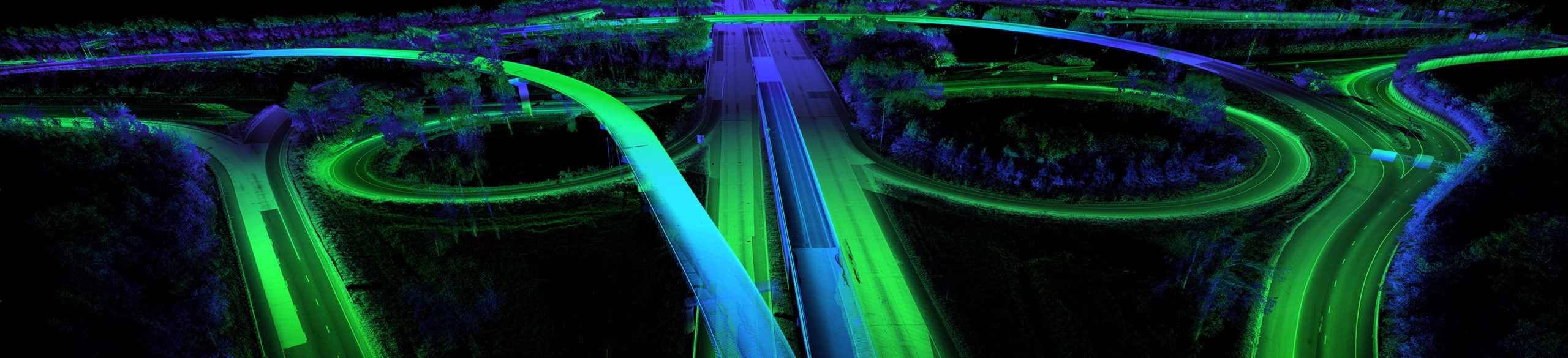
From traditional survey crews to stationary lidar scanners and mobile ground lidar to aerial mapping, we consistently provide high-quality surveying services with cutting-edge technology and speed. We efficiently gather accurate data in hard-to-reach areas, providing clients with a greater depth of information about roadway and structure features. And when employing technologies such as mobile mapping, our teams are able to reduce collection time, eliminate costly lane closures and temporary traffic disruptions, and safely keep surveyors out of harm’s way.
Featured Projects
Insights
Capabilities
- Aerial lidar
- Aerial photography and photogrammetry
- Asset inventory/management
- Intelligent transportation systems
- Mobile lidar mapping
- Subsurface utility engineering
- Surveying
- Terrestrial laser scanning
- Unmanned aircraft systems