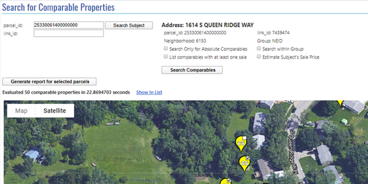
Comparable Properties
The Comparable Properties add-on module identifies properties comparable to a subject parcel and determines if the subject’s current valuation is fair and equitable. With access to both sold and unsold (estimated, fair market) values, this module enables appraisers to generate the supporting evidence needed to reduce costly and time-consuming appeals.
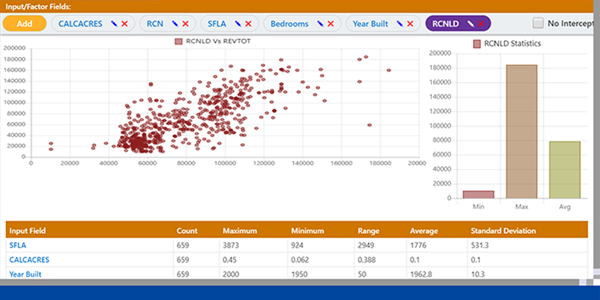
Data Analyzer
Data Analyzer helps appraisers leverage their experience to perform multiple regression analysis against the data hosted in CAMACloud. The user-friendly interface enables appraisers to build and test valuation models based upon their local knowledge—and without needing a statistician. High-quality analytics lead to more accurate assessment values and reduce assessment appeals.
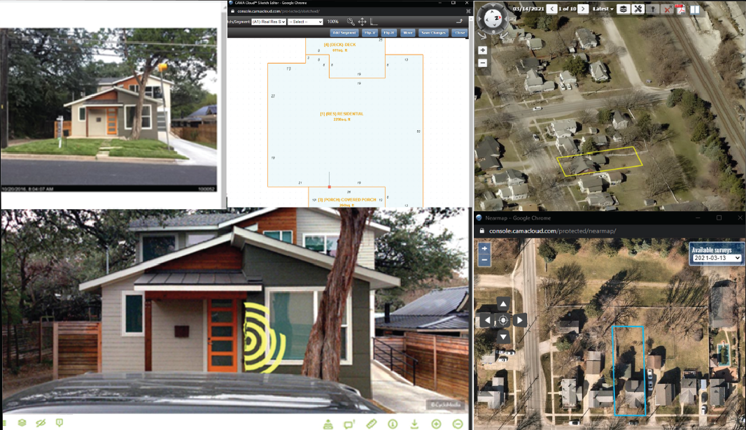
Desktop Review
The Desktop Review module helps jurisdictions locate new or razed structures, verify existing data and flag data discrepancies. Desktop Review integrates virtually all data assets into a synchronized system with customizable workflows to support the complete remote verification of 180 to 300 parcels per person per day—far more than the traditional method’s 45 to 65 parcels/person/day. Additionally, Desktop Review provides a complete audit trail of all workflow triggers, field visits and property edits.
With Desktop Review, you can:
- Access photos taken in the field through Instant PhotoBase
- Apply the same quick, easy and efficient tools as in the field for sketching
- Assign field visits for additional data verification collection needs through MobileAssessor
- Integrate with Cyclomedia
- Review high-quality aerial imagery (ortho and oblique)
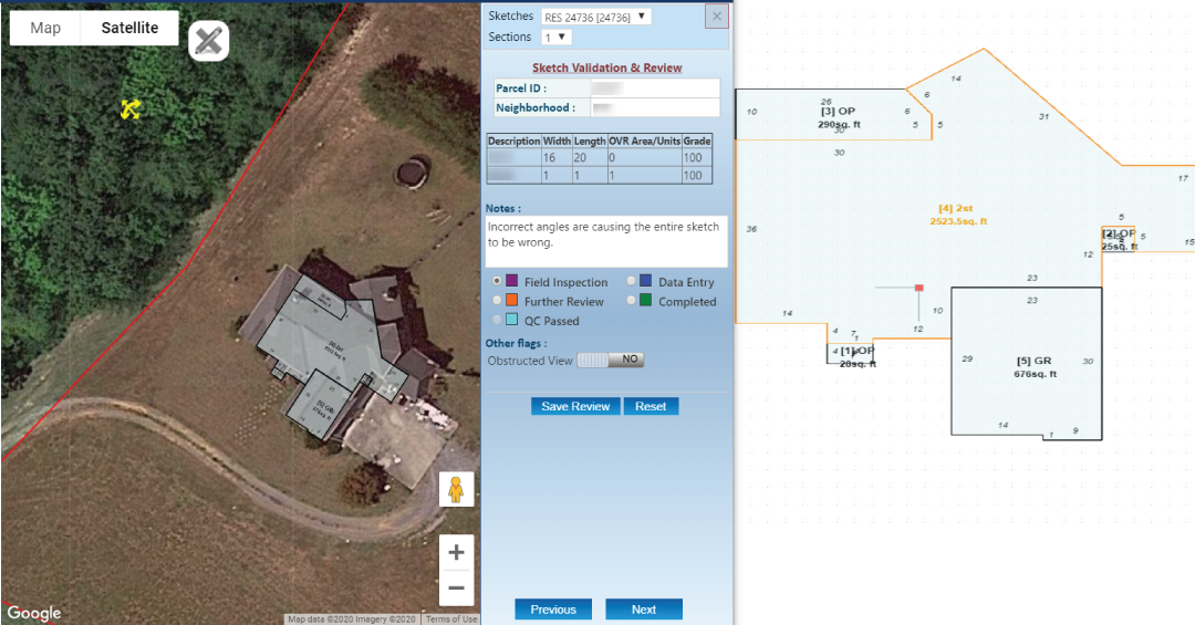
Sketch Validation
With Sketch Validation, identify and correct new construction, razes or even clerical errors quickly and efficiently before entering the field. Using the most current CAMA data, sketches and imagery, this module provides a more comprehensive approach than simple imagery comparison to simplify reappraisals and ensure fair and equitable taxation.
This module overlays sketches from your CAMA system onto aerial photography. Users can rotate and scale sketches to verify existing structures against the aerials. Parcels can then be grouped into categories customized to your needs: confirmed, demolition, field visit, further review, new construction, etc.
With Sketch Validation you can:
- Easily capture audit, review and field visit details
- Reduce costs per parcel through increased productivity
- Validate more properties by reducing unnecessary or duplicate parcel visits