MobileAssessor®
CAMACloud flagship module MobileAssessor® is the first software of its kind to optimize field data collection for the mass appraisal market. Hosted on the cloud and compatible with all data platforms, MobileAssessor fully integrates with any CAMA system and works seamlessly with imagery from most mainstream providers. Using live GPS and GIS mapping, MobileAssessor makes it easy to review property data, capture and modify data and set flags from the field or in the office. Automated CAMA synchronization and convenient record access empower appraisers to get more done in less time.
Admin Console
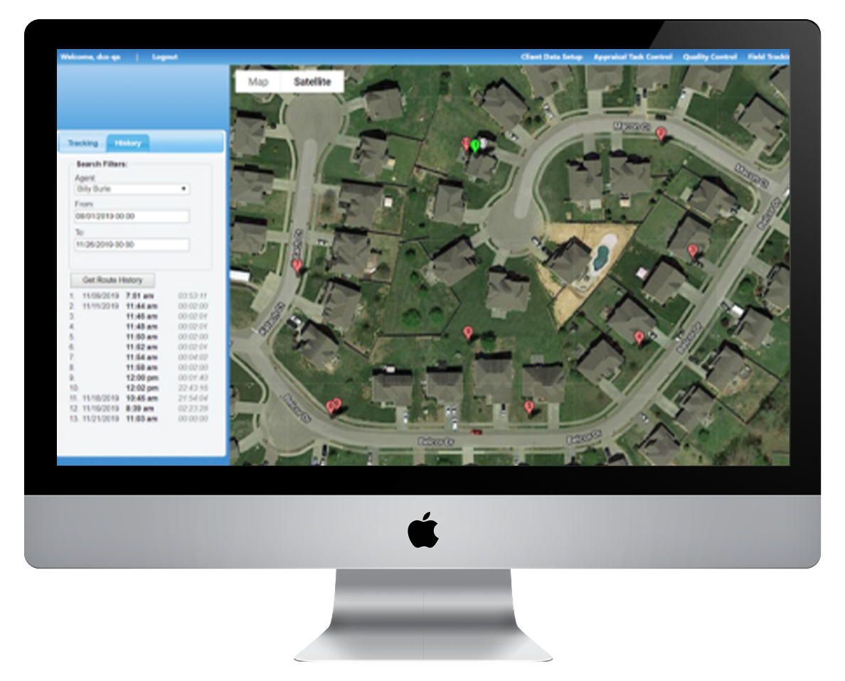
Included in the base MobileAssessor module, the browser-based Admin Console supports appraisal tasks, quality control, field tracking, configuration settings and reporting.
With Admin Console, you can:
- Create parcel assignments and workflow processes
- Decrease office foot traffic with real-time, in-field syncing
- Eliminate paper consumption
- Improve data quality and eliminate duplication with live quality control
- Increase staff safety with live location tracking
- Reallocate time to other projects
- Reduce time spent assigning work
- Track productivity through dashboards and reports
MobileAssessor Features
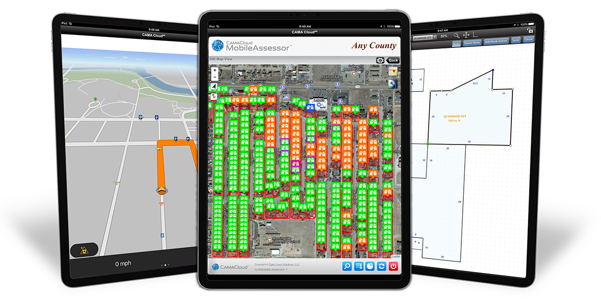
- Digital property record cards (PRC): Interactive PRCs enable field appraisers or data collectors to make edits, review details, take photos and alter sketches.
- Instant, synchronized photo association: Instant PhotoBaseSM automatically uploads, synchronizes and associates photos and data to parcels in real time.
- Interactive GPS and GIS: Interactive GPS virtually eliminates the misidentification of properties, and the GIS automatically shades parcels according to status.
- Dynamic routing: Quickly plan parcel visitation routes based upon location, direction of travel or urgency.
- Market statistics: Neighborhood profiles provide fundamental data about nearby appraisals and sales activity.
- Real-time quality control: Instantly and intuitively review in-field data collections and changes.
- Touchscreen sketching: Apply automatic angle calculations, check quality assurance, split lines, move unanchored segments/additions and use polygon tools with 100% compatibility.
MobileAssessor Lite
Light on price but not on function, MobileAssessor Lite offers many of MobileAssessor’s most-useful features without all the bells and whistles. It supports:
- Data collection
- Optimized travel routing
- Photo association
- Quality control
- Standard reports and dashboards
Lite’s lower upfront costs and reduced implementation times are great for jurisdictions with limited budgets or tight timeframes. MobileAssessor Lite is also a great solution for reappraisal companies looking to improve the efficiency of reassessment projects.
*Please note, MobileAssessor Lite does not include full CAMA integration.